
Oman in full: a 20-day 4x4 loop from Muscat to Salalah and back
Wahiba · Duqm · Salalah · Jebel Shams
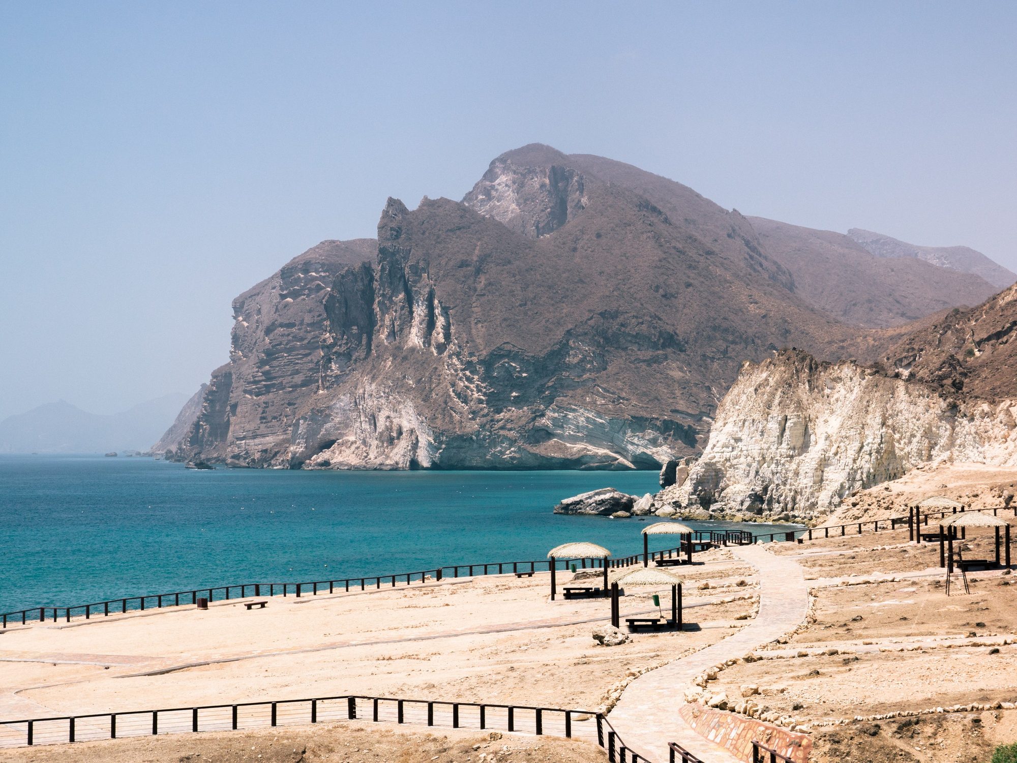
Photo: Juozas Šalna (Flickr: pukomuko / username 'pkmk', ID 7214903@N03). The Commons Author field is only the Flickr URL https://www.flickr.com/photos/pukomuko/, and the name comes from the category 'Files from Juozas Šalna Flickr stream'. · CC BY 2.0
This is the long loop: almost every landscape in Oman in 20 days, from Muscat and back. You follow the coast to Sur and the turtles of Ras al Jinz and sleep two nights in the Wahiba Sands. Then you drive south along the Arabian Sea to the white Sugar Dunes, Duqm and Dhofar, the mountainous south around Salalah. After three nights in Salalah, you return north through the central desert to Nizwa, the canyon rim of Jebel Shams and the terraces of Jebel Akhdar, and end in Muscat.
Read more
The roads are good, but the distances in the south are long. Duqm to Salalah is about 640 km on the A11 coast road, and Salalah to Nizwa is about 880 km on the N3 (Route 31 on older maps) through the desert. We split both into shorter days, but Day 9 (about 360 km) and Day 14 (about 500 km) are still long. Towns and fuel stations are far apart there, so fill up whenever the tank is half empty. From October to April Dhofar is dry and warm; the monsoon, the khareef, comes from June to September.
Our rental rules apply all the way: existing tracks, open dunes and beaches in daylight only, beaches only where driving is allowed, no driving in wadis, and no leaving Oman. You sleep in the rooftop tent on 13 nights, with hotel nights in Duqm, Salalah, Nizwa and Muscat. There are three longer stays: two nights in the Wahiba Sands, three in Salalah and two on Jebel Shams.
All trip details
Photos
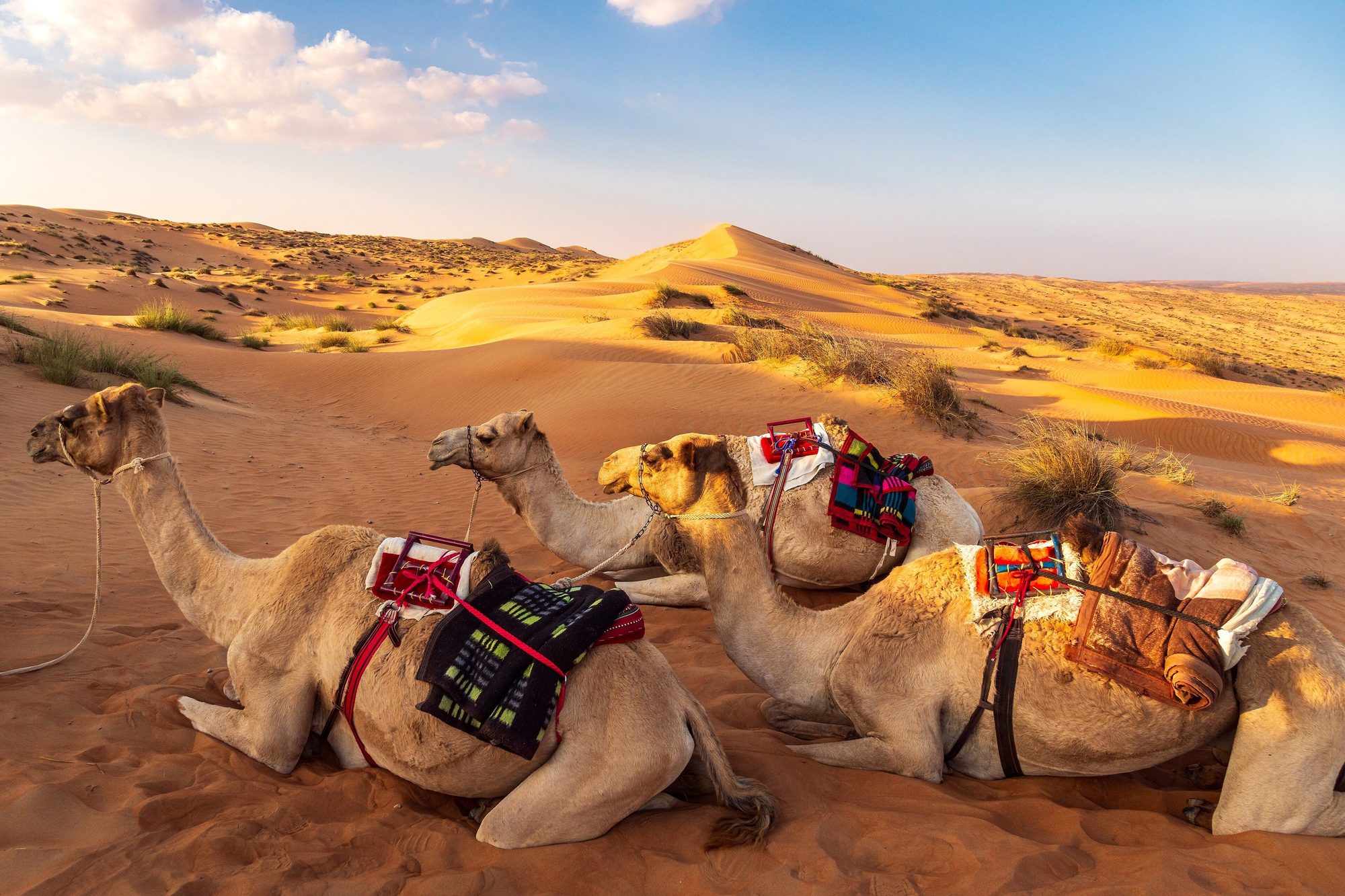
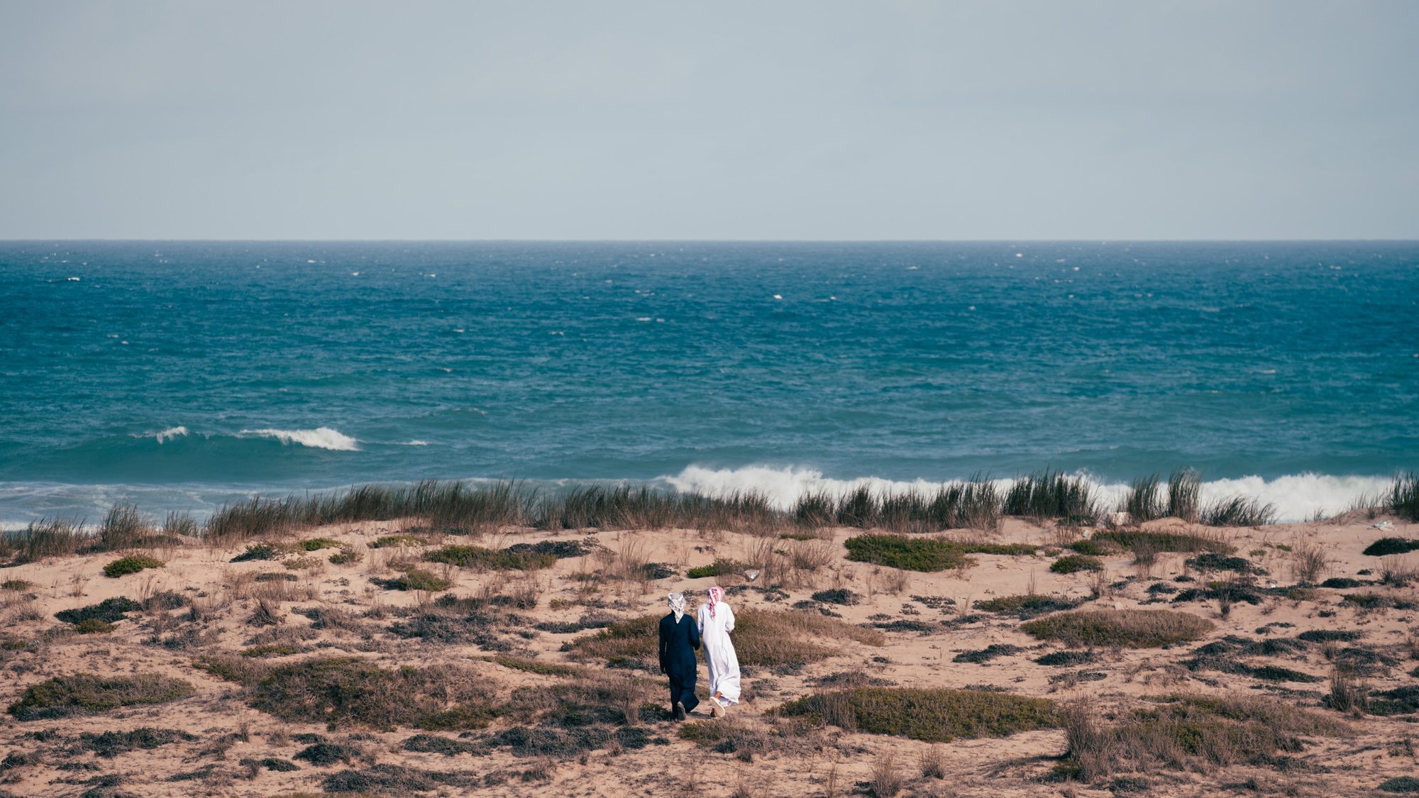
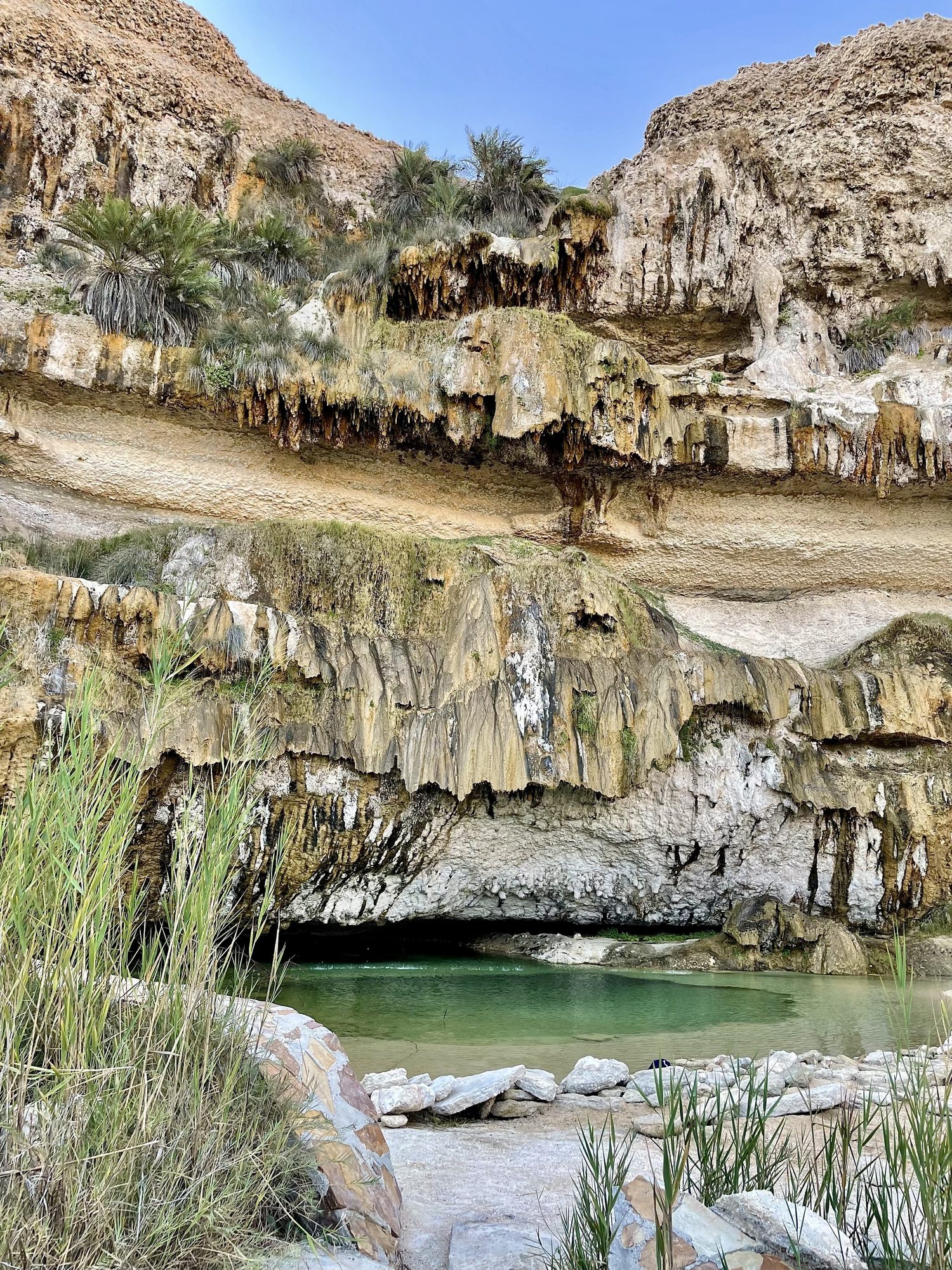
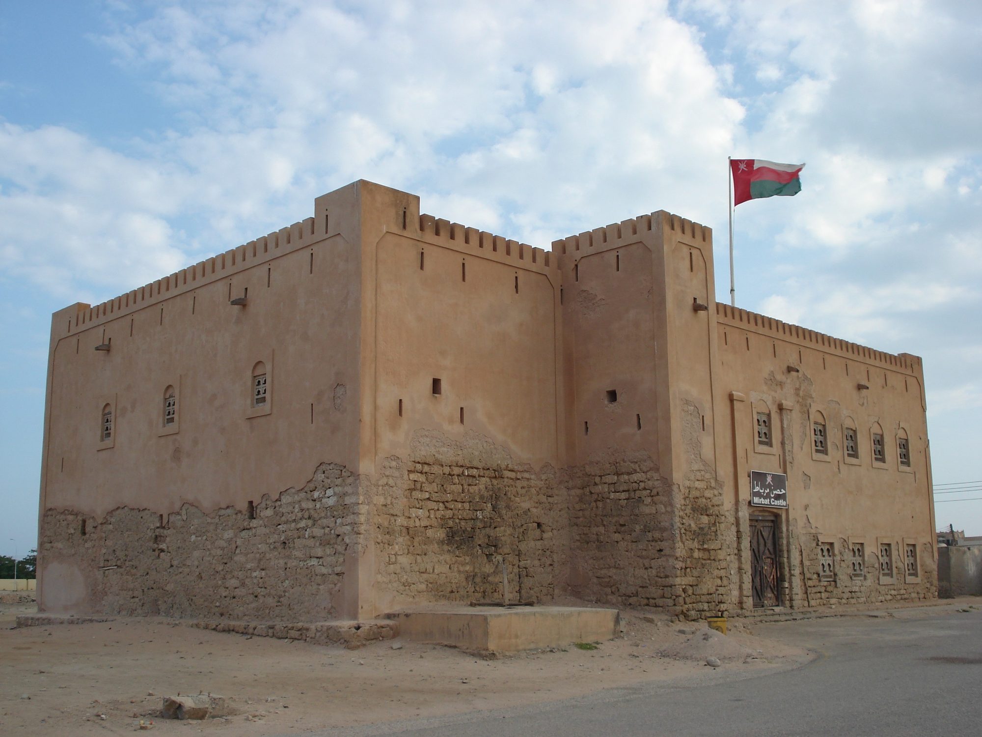
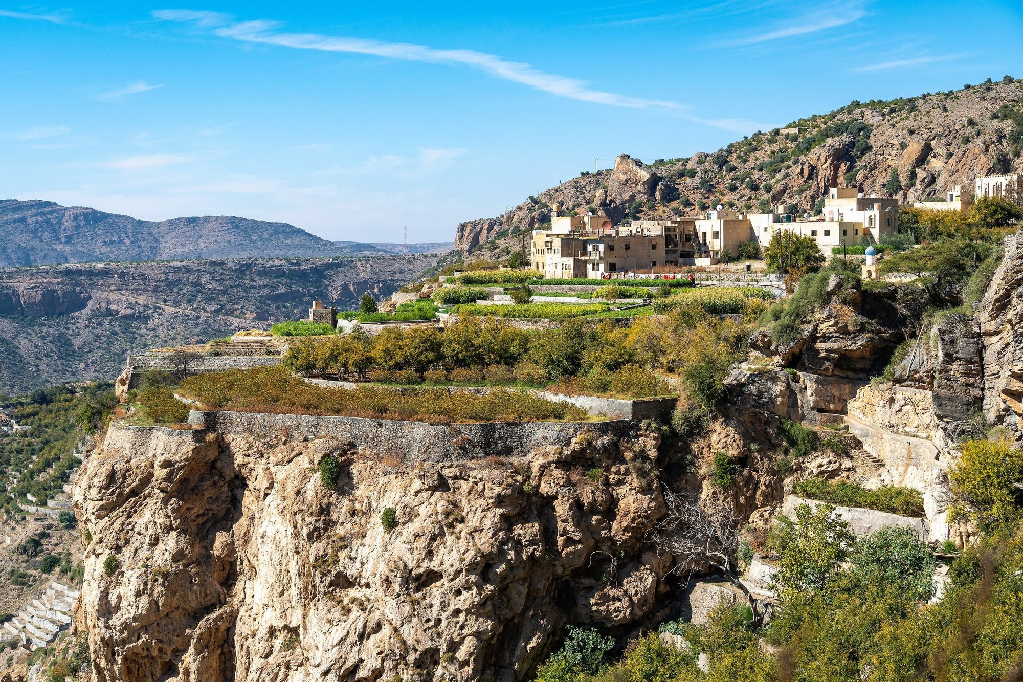
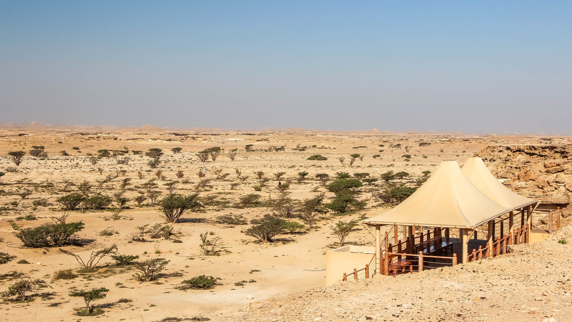
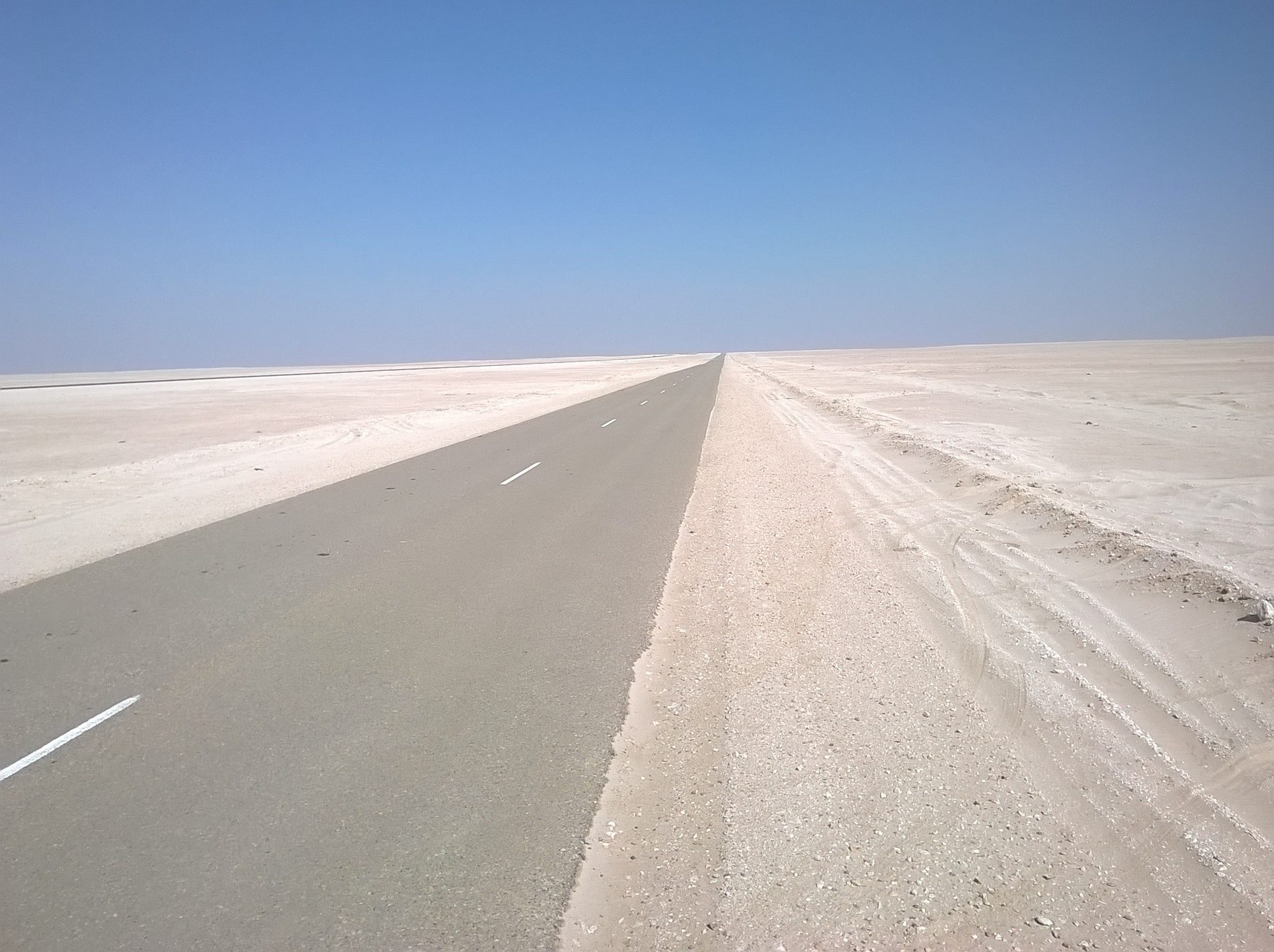
Route map
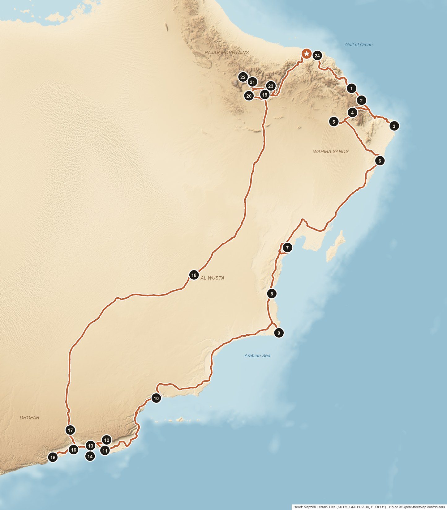
- ★Start and end: Muscat International Airport or your hotel in Muscat
- 1Bimmah Sinkhole (Hawiyat Najm Park) · Day 1
- 2Wadi Shab · Day 2
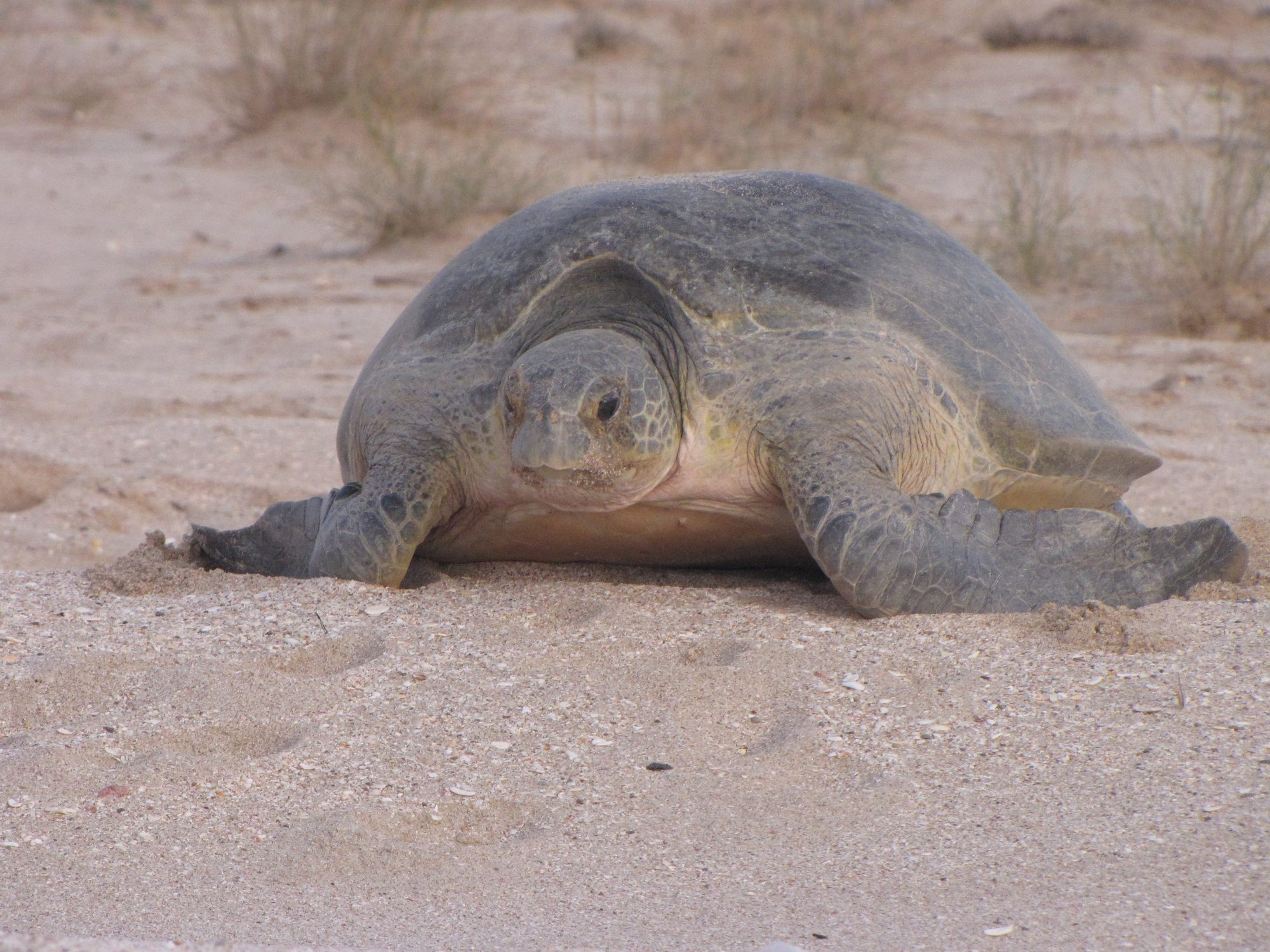
- 3Ras al Jinz Turtle Reserve · Day 2
- 4Wadi Bani Khalid · Day 3
- 5Al Wasil · Day 3
- 6Al Ashkharah · Day 5
- 7Sugar Dunes · Day 6
- 8Duqm Rock Garden · Day 7
- 9Ras Madrakah · Day 8
- 10Wadi Shuwaymiyah · Day 9
- 11Mirbat · Day 10
- 12Jebel Samhan viewpoint · Day 10
- 13Wadi Darbat · Day 11
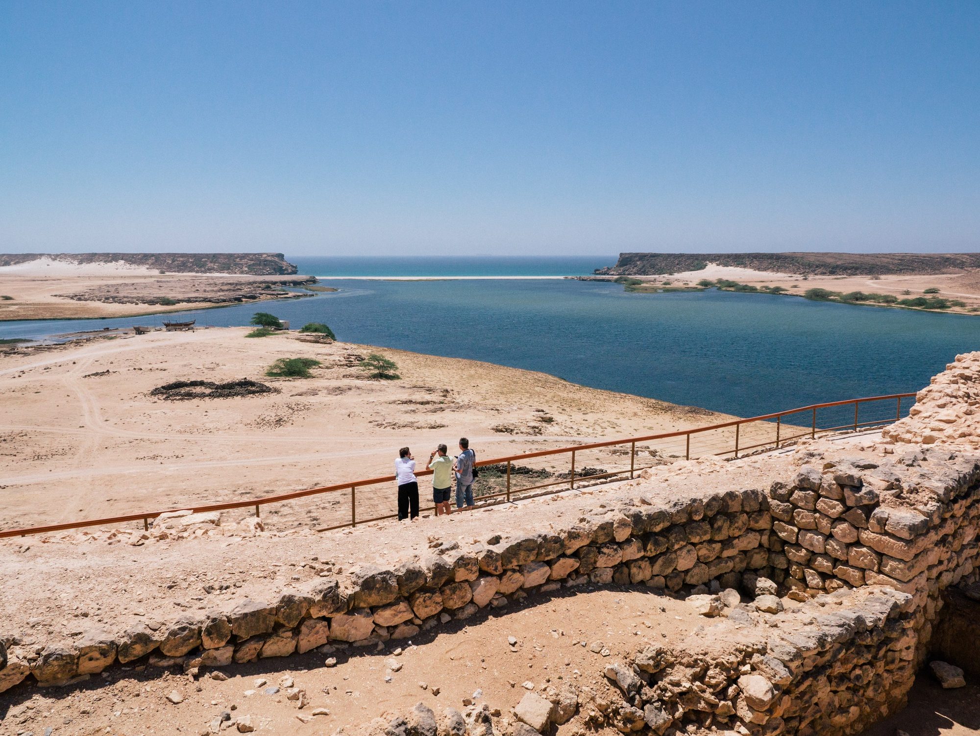
- 14Khor Rori and Sumhuram · Day 11
- 15Marneef Cave and the blowholes · Day 12
- 16Al Baleed Archaeological Park and the Museum of the Frankincense Land · Day 12
- 17Wadi Dawkah · Day 14
- 18Haima · Day 14
- 19Nizwa Fort and souq · Day 15
- 20Jabrin Castle · Day 16
- 21Misfat al Abriyeen · Day 16
- 22Balcony Walk (W6) · Day 17
- 23Wadi Bani Habib · Day 18
- 24Sultan Qaboos Grand Mosque · Day 20
Day by day
Day 1
Muscat to Bimmah Sinkhole and Fins Beach- Supermarkets in Al Amerat
- 1Bimmah Sinkhole (Hawiyat Najm Park)
- Fins Beach
Details
Collect your car at the airport or at your hotel. Before you leave, ask our team to show you the rooftop tent, the electric fridge and its separate freezer, and the compressor. This is a long trip, so take time to pack the car well. Buy food and water in Muscat, because the shops get smaller further south. Then take the A2 (Route 17) out of the city. The highway crosses bare mountains and reaches the coast near Quriyat. Swim in the Bimmah Sinkhole in the afternoon and arrive in Fins before sunset.
- Supermarkets in Al Amerat — Large supermarkets on the A2 as you leave Muscat. Buy food and drinking water for at least three days and fill the tank.
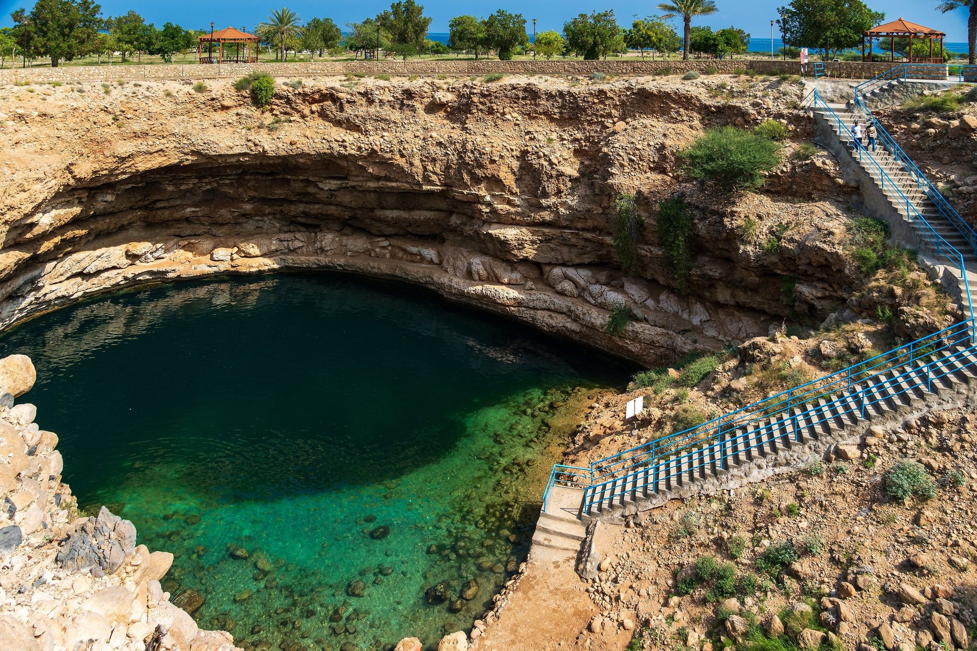
- 1Bimmah Sinkhole (Hawiyat Najm Park) — A limestone sinkhole with clear blue-green, slightly salty water inside a small park, between the villages of Dibab and Bimmah. Concrete steps lead down to the water, and you swim at your own risk: there is no lifeguard. The park has toilets, shade and picnic tables. In recent reports entry was free or about 500 baisa, so carry small cash and check before you go. Swim in modest swimwear or a T-shirt and shorts.
- Fins Beach — White sand and dark rocks along the sea. Walk along the shore at sunset.
Where to sleep: On firm ground behind the beach at Fins, at least 10 m back from the shoreline and at least 100 m from houses, away from fishermen's boats. Fins is in Muscat Governorate: you may camp for up to 48 hours without a permit, longer stays need a Muscat Municipality permit, and fires and barbecues are not allowed on the beach. Weekends (Friday and Saturday) are busy.Tip: Open and close the rooftop tent once at the handover, in daylight. Then it takes only a few minutes on the first evening.Photo: Muiad123 · CC BY-SA 4.0
Day 2
Wadi Shab, Sur and the turtles of Ras al Jinz- 2Wadi Shab
- Qalhat
- Sur dhow yard and Al Ayjah lighthouse
- 3Ras al Jinz Turtle Reserve
Details
Leave early and be at the Wadi Shab car park around 8:00, when the boats start running. In the morning the wadi is quiet and cool. After lunch, drive past Qalhat to Sur. In the boatyard by the lagoon, carpenters still shape wooden dhows the traditional way. Cross the bridge to Al Ayjah for the lighthouse and the view back over the old town. In the late afternoon, continue to Ras al Hadd at the eastern tip of Oman. Have dinner there and arrive at the reserve by 20:30 for the night tour.
- 2Wadi Shab — A short boat ride across the water (about OMR 1 per person return in 2026; boats run from about 8:00 to 17:00), then 45 to 60 minutes on foot each way past palm gardens and cliffs to green pools. Strong swimmers can continue to a cave with a small waterfall. Wear shoes that can get wet, and do not go in if rain is forecast.
- Qalhat — A UNESCO site with the early 14th-century mausoleum of Bibi Maryam. The site has been closed for excavations in recent years, but you can see the mausoleum from the barrier. Check before you go.
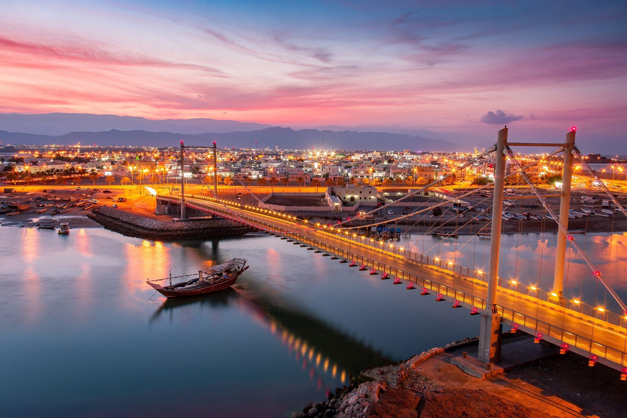
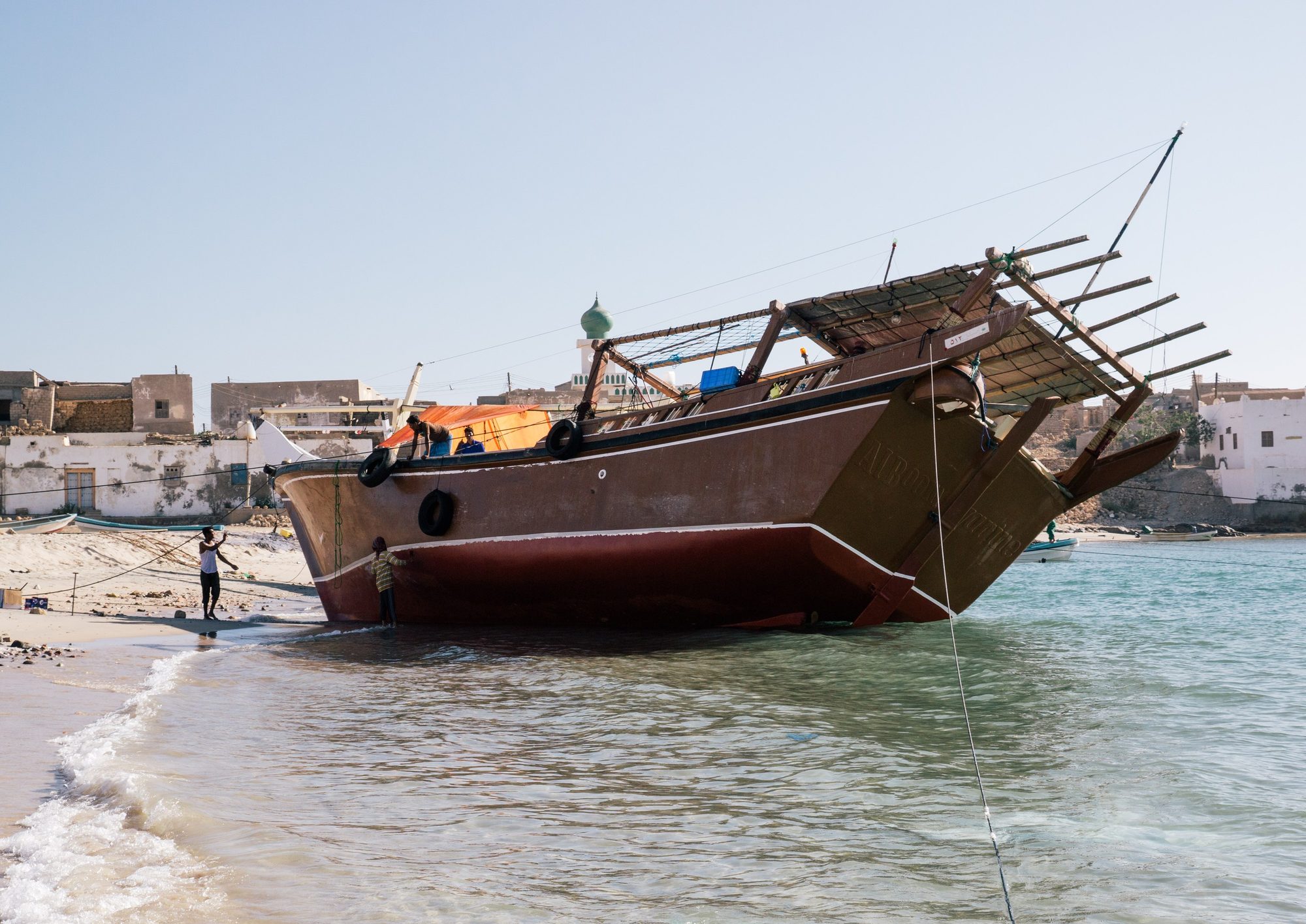
- Sur dhow yard and Al Ayjah lighthouse — Watch wooden dhows being built, see the restored Fatah Al Khair dhow, then cross the bridge to the white lighthouse of Al Ayjah. Ask before you photograph people.
- 3Ras al Jinz Turtle Reserve — Guided night tour from 21:00 (arrive by 20:30). A reserve guide leads small groups onto the beach to watch green turtles nest. Plan about 1.5 to 2 hours. The guides use red torches only: no flash and no phone lights. Times can change with the season, so confirm them when you book.
Where to sleep: Not on the beach. The coast from Ras al Hadd to Ras al Jinz is a protected turtle reserve: camping on the nesting beaches at night and driving on the beach are prohibited, and at night you may go onto the nesting beaches only with a reserve guide. Choose your spot in daylight, before the tour: flat gravel ground several kilometres inland, right next to the paved road, outside the reserve and away from villages, farms and wadi beds. Drive there slowly after the tour and stay on the paved road: our cars may not drive off-road after dark. If you prefer not to drive after dark, book a room or eco-tent at the reserve (room rates include the night and dawn turtle tours) or a hotel in Ras al Hadd.Tip: Book the turtle tour before your trip, online, by phone or by email; the contacts are on the reserve's official website. Places are limited, so book early for weekends and holidays.Photo: Andries Oudshoorn · CC BY-SA 2.0
Day 3
Ras al Jinz to Wadi Bani Khalid and the Wahiba Sands- Ras al Jinz dawn tour (optional)
- 4Wadi Bani Khalid
- 5Al Wasil
Details
If you saw no turtles last night, join the dawn tour at 5:00 (a separate ticket unless you stay at the reserve). Then drive back to Sur and take the N4 inland across wide gravel plains. A side road climbs into the hills to Wadi Bani Khalid, where green pools lie between palm trees and large boulders. Swim there in the late morning. In the afternoon, return to the N4 and drive west to Al Wasil. Lower your tyre pressure there and follow the marked track into the orange dunes of the Wahiba Sands, now officially named the Sharqiya Sands.
- Ras al Jinz dawn tour (optional) — Starts at 5:00; arrive by 4:45. You may see the last turtles going back to the sea and, in season, hatchlings.
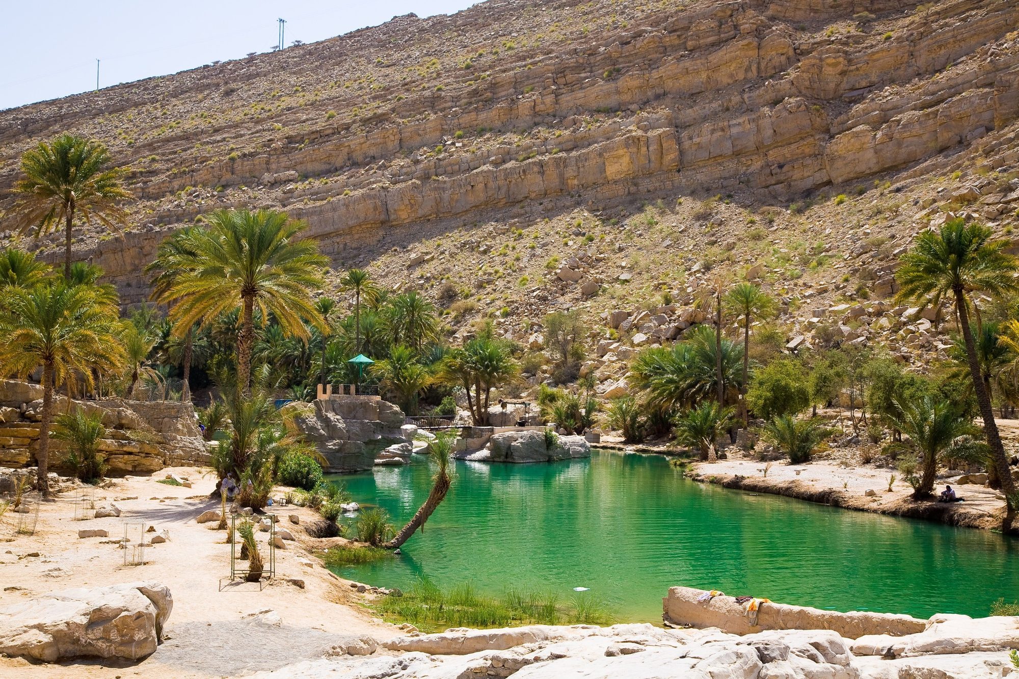
- 4Wadi Bani Khalid — Entry is free, and most 2025–2026 reports say parking is free too. The car park toilets cost about 400 baisa and the changing tents about 100 baisa, in cash. The first pools are less than 5 minutes' walk from the car park, and Muqal Cave is about 1 km further up the wadi. Bring a head torch for the cave. Signs ask swimmers to cover upper arms and knees.
- 5Al Wasil — Fill the tank at Al Wasil, the last fuel before the sand. Lower the tyres to about 18–20 psi (1.2–1.4 bar) with the gauge in your kit before you leave the tarmac. Small tyre shops in the area can also help.
Where to sleep: Option 1: a desert camp on a marked track from Al Wasil or Al Mintirib. Prices vary a lot. In 2025–2026 listings, simple camps started at roughly OMR 15–25 per person with dinner and breakfast, and luxury camps cost OMR 100 or more per tent per night. Prices change with the season, so check before you go. You can also ask a camp if you may sleep in your own rooftop tent and pay for dinner and showers. Option 2: the edge of the dunes. Stop on firm, flat ground, out of sight of houses, farms, camel pens and other camps. Reach your spot in daylight: do not drive on sand after dark. Book two nights: tomorrow is a rest day.Tip: Plan to reach Al Wasil by 15:30. From mid-November to January the sun sets between about 17:20 and 17:50, and our cars may drive on sand only in daylight. If you are late, skip the walk to Muqal Cave.Day 4
A slow day in the Wahiba Sands- Sunrise dune walk
- Camel ride or Bedouin visit
- Al Mintirib
- Guided dune trip
Details
Stay a second night in the desert. Walk up a dune for the sunrise and have a slow breakfast. In the cooler morning, drive to the old town of Al Mintirib on the northern edge of the sands. Back at camp, rest in the shade during the hot hours. Your camp can arrange a camel ride or a visit to a Bedouin family. Return to the dunes on foot for the sunset and a dark, clear night sky.
- Sunrise dune walk — Start walking up the nearest high dune about 30 minutes before sunrise, which is between about 6:10 and 6:45 from November to January. Walk, do not drive: our rental rules allow driving on the dunes only in daylight.
- Camel ride or Bedouin visit — Ask your camp. Prices vary a lot between camps, so agree the price before you start.
- Al Mintirib — An old town about 9 km from Al Wasil, with a large mud-brick fort, palm gardens and old houses. The fort has been reported open only in the morning, Sunday to Thursday (about 7:30–14:30), so go early and check locally.
- Guided dune trip — If you want to see the high dunes up close, book a trip with a licensed local driver in their own vehicle. You may also drive on the open dunes yourself in daylight: lower the tyre pressure, use low range and, if you have never driven on sand, start with small dunes.
Where to sleep: Stay at the same camp or the same spot at the edge of the dunes. If you move to another camp, use its marked track and arrive before dark.Tip: The sand is very hot at midday and the light is flat. Plan walks for the first and last two hours of daylight, and drink often even when it feels cool. Desert nights from December to February are cool, often around 10–15 °C and sometimes colder, so keep warm layers ready.Photo: Erfan.arafat · CC BY-SA 4.0
Day 5
Wahiba Sands to Jalan Bani Bu Ali and Al Ashkharah- Al Wasil
- Jalan Bani Bu Ali
- 6Al Ashkharah
Details
An easy day after the desert. Drive out on the same track in the cool morning and pump the tyres back to road pressure in Al Wasil. The N4 runs south-east to Al Kamil. From there, road S42 leads to the old town of Jalan Bani Bu Ali and on to the coast at Al Ashkharah, a fishing town on the Arabian Sea. Spend the afternoon by the sea.
- Al Wasil — Use the compressor in your kit to pump the tyres back to the pressure on the driver's door sticker. Do not drive fast on tarmac with soft tyres.
- Jalan Bani Bu Ali — Old town with a crumbling fort and Jami al Hamoda, a mosque with 52 small domes. Non-Muslims may not enter the mosque; see it from outside.
- 6Al Ashkharah — Fishing harbour and kilometres of sandy beach on the Arabian Sea. The coast is often windy: swim only when the sea is calm.
Where to sleep: On firm ground behind the beach south of Al Ashkharah town, out of sight of houses and away from fishing boats and nets. Park above the high-tide line, and drive on the beach only in daylight. If you see turtle tracks, move further away and keep your lights off towards the sea.Tip: Fill the tank in Al Ashkharah. Further south the coast road has only two small stations (near Ras Jibsh and Al Khuwaymah, about 55 and 70 km south), then none for about 130 km until Hij (Mahout).Day 6
Al Ashkharah to the Sugar Dunes of Al Khaluf- Hij (Mahout)
- Al Khaluf
- 7Sugar Dunes
Details
Today you leave the busy coast. Road S42 runs for about 200 km between the edge of the Wahiba Sands and the Arabian Sea, past small fishing villages. In Hij, fill the tank and buy fresh food and water. Then follow Route 32 south and turn off at the salt works: a dirt track leads to the dunes without using the beach. Before the soft sand near the dunes, lower the tyre pressure to about 1.4 bar (20 psi). A beach route also runs from Al Khaluf. Our cars may take it in daylight and at low tide, but the southern track is easier. The Sugar Dunes are dunes of very fine, almost white sand right next to the sea.
- Hij (Mahout) — The last town with shops and several fuel stations before the dunes.
- Al Khaluf — A small fishing village north of the dunes, on the paved road L712, with a small fuel station that keeps irregular hours. At low tide you can walk to Humrat Cave on the nearby coast. From here a 4x4 route with about 15 km on the beach also leads to the dunes. If you take it, check the tide times, drive in daylight at low tide, lower the tyre pressure first and keep to the firm sand, out of the water.
- 7Sugar Dunes — Park on firm ground at the edge of the dunes and walk up, or drive onto the dunes in daylight with lowered tyre pressure. If you are new to sand, keep off the steep slip faces. The light is best at sunset and sunrise. Swim only when the sea is calm.
Where to sleep: On firm sand between the dunes and the beach, well above the high-tide line, with a dune between you and the wind. Choose your spot and park before dark: our cars may not drive on sand after dark. There are no facilities: take all rubbish with you, including toilet paper.Tip: Reach the salt works turn-off by early afternoon, so you drive the track and the soft sand in daylight. If you take the beach route from Al Khaluf instead, check the tide times first and drive it at low tide.Day 7
Sugar Dunes to Duqm and the Rock Garden- Sugar Dunes at sunrise
- Duqm
- 8Duqm Rock Garden
Details
Watch the sunrise from the top of a dune, then leave by the same southern track in daylight. Inflate the tyres again before the asphalt. The A8 runs south across flat, empty desert to Duqm, a new port town in a large special economic zone. Check in at your hotel, fill the tank and buy food and water for the next three days. In the late afternoon, when the light is soft, walk through the Rock Garden.
- Sugar Dunes at sunrise — Walk up the nearest dune about 30 minutes before sunrise. Walk, do not drive: our cars may drive on the dunes only in daylight.
- Duqm — The last large town before Salalah, with supermarkets, several fuel stations and hotels. Buy food and drinking water for at least three days: shops on the coast road further south are few and small.
- 8Duqm Rock Garden — A field of soft limestone rocks with a harder cap, shaped by wind and water into strange forms over millions of years, spread over several square kilometres near the town. The site is fenced, with gates and a car park. In February 2025 visitors reported free entry. Since 2019 visitors have been asked to register online on the Duqm Special Economic Zone website (duqm.gov.om), so check before you go. Walk between the rocks, do not climb them, and take nothing away.
Where to sleep: We suggest a hotel in Duqm tonight: after six nights in the tent, a shower and a bed help before the coast road. Book ahead. If you prefer to camp, choose open public ground well outside the town, away from the port, industrial areas, building sites and fenced land.Tip: Fill the tank in Duqm. After Duqm, the last station before Ras Madrakah is in Dhahar. From Dhahar to Haitam there is none: about 150 km with the detour to Ras Madrakah. Fill up whenever the tank is half empty.Day 8
Duqm to Ras Madrakah- Dhahar
- 9Ras Madrakah
Details
A short day on the coast of Duqm. If you missed the Rock Garden yesterday, go early, in the soft morning light. Then drive south on the A11 and fill the tank in Dhahar. After Dhahar, the L726 turns off to Ras Madrakah, a fishing village where headlands of dark rock separate bays of white sand. Spend the afternoon walking along the shore and choose your spot for the night in daylight. In the morning, sea mist is common.
- Dhahar — A small village on the A11 south of Duqm with a fuel station. Fill up here: after Ras Madrakah the next fuel is in Haitam, about 120 km away.
- 9Ras Madrakah — A fishing village about 80 km by road south of Duqm, at the end of a paved road. Headlands of dark volcanic rock meet soft white sand, and the bays are popular for camping and fishing. The weather is pleasant from about September to March. Rubbish washed up by the sea is a problem on some bays: take yours with you.
Where to sleep: On firm ground above one of the bays near Ras Madrakah, well above the high-tide line, out of sight of houses and away from fishermen's boats and nets. The ground above the main beach is rocky, which suits a rooftop tent. In daylight you may drive on the beach and on sandy tracks, but check the tide first. Do not take the rocky tracks to the headlands: ask us which tracks you may use. There are no facilities: take all rubbish with you, including toilet paper.Tip: Fill the tank in Duqm or Dhahar before the detour. From Ras Madrakah to the next station, in Haitam, is about 120 km.Photo: Anood Al Jabri · CC BY-SA 4.0
Day 9
Ras Madrakah to Ash Shuwaymiyah on the coast road- Haitam
- Salt lagoons near Al Kahil
- Al Lakbi and Shalim
- 10Wadi Shuwaymiyah
Details
One of the longest days of the trip, so leave by 8:00. The A11 crosses white plains beside the sea, passes pink salt lagoons and climbs about 200 m onto the Jiddat Arkad plateau. Villages are far apart, and camels often walk along the road. Buy fuel and supplies in Haitam and take a break every two hours. In the afternoon the road reaches Ash Shuwaymiyah, a fishing village below high white limestone cliffs.
- Haitam — A small town on the A11 about 120 km from Ras Madrakah, with a fuel station and a supermarket. Fresh food is limited.
- Salt lagoons near Al Kahil — Pink salt lagoons a short detour from the A11, where flamingos and other birds feed in winter. They can be almost dry. Do not drive onto the salt flats, which can be soft, and ask us which tracks you may use. Al Kahil has a fuel station.
- Al Lakbi and Shalim — Fishing villages with fuel stations, about 90 km and 200 km after Haitam. Fill up in both if the tank is half empty.
- 10Wadi Shuwaymiyah — A wide wadi between white limestone cliffs behind the village, with acacia trees. The palm oasis and the pool below a small waterfall, which is only a trickle outside the khareef, are about 11 km up the wadi on a gravel track along the wadi bed. Driving in wadis is not allowed with our cars, so do not drive this track. Instead, walk a short way into the mouth of the wadi from the village; the waterfall is too far for a short walk.
Where to sleep: On firm ground behind the beach at Ash Shuwaymiyah, well above the high-tide line, out of sight of houses and away from fishing boats. Never camp in Wadi Shuwaymiyah or in any other wadi bed. If you see turtle tracks, move further away and keep your lights off towards the sea. Take all rubbish with you.Tip: This is the emptiest part of the trip. From Ras Madrakah, the next station is in Haitam, about 120 km away. After that there are stations in Al Kahil, Al Lakbi, Shalim and Ash Shuwaymiyah, with a few smaller ones between them, no more than about 100 km apart. Fill up at each one if the tank is half empty, and carry food and water for an extra day.Photo: 9591353082 at English Wikipedia · CC BY 2.5
Day 10
Ash Shuwaymiyah to Hasik, Mirbat and Jebel Samhan- Hasik
- Sadah Castle
- 11Mirbat
- Wadi Hinna baobabs
- 12Jebel Samhan viewpoint
Details
For many travellers this is the finest part of the coast road. After Ash Shuwaymiyah the A11 climbs through the mountains towards Hasik, then drops back to white beaches and fishing villages. Visit the castles of Sadah and Mirbat. West of Mirbat, turn north onto the road to Tawi Attair, stop at the baobab trees of Wadi Hinna and climb into the hills. Arrive at the Jebel Samhan viewpoint in the late afternoon and watch the light change over the coast far below.
- Hasik — A fishing village with the ruins of an old town and harbour nearby. Sea turtles and migrating birds are often seen along this coast. Hasik has a fuel station.
- Sadah Castle — The easternmost fort on the Dhofar coast, restored in 1991. The official hours are Sunday to Thursday 7:30 to 14:30 and 15:00 to 18:00, Friday 9:00 to 12:00 and 14:30 to 18:00, and Saturday 9:00 to 13:00 and 14:30 to 18:00. Check before you go.
- 11Mirbat — Mirbat Castle overlooks the old harbour and the traditional market. The official tourism website gives daily hours of 8:00 to 19:00; tickets are sold at the entrance. Walk past the old merchant houses with carved wooden doors near the beach. Strong currents make the beach unsafe for swimming. Fill the tank here before the climb.
- Wadi Hinna baobabs — A grove of baobab trees about 15 km west of Mirbat, on the road to Tawi Attair. A footpath leads from the car park into the grove.
- 12Jebel Samhan viewpoint — A public viewpoint on the Jebel Samhan road (D802), about 19 km east of Tawi Attair, high above the coastal plain. Further east the road enters the Jabal Samhan Nature Reserve, one of the last wild homes of the Arabian leopard. Most of the reserve is closed to the public. Where visits are allowed, they are only at the permitted times, and camping, staying overnight and flying drones need a permit from the Environment Authority. Respect signs and fences.
Where to sleep: At the Jebel Samhan viewpoint, on flat ground well back from the edge. Do not drive on into the nature reserve to camp: camping or staying overnight inside the reserve needs a permit from the Environment Authority. Where the reserve starts may not be signposted, so check before you go. If you are not sure, decide in Mirbat and drive on to a hotel in Salalah (about 1 hour), so you do not drive the mountain roads after dark. Keep away from farms and camel enclosures, cook only on the gas stove and do not drive over plants. Nights up here are cooler than on the coast. Take all rubbish with you.Tip: Watch for camels on the mountain roads, especially around bends. Plan to leave Mirbat by about 15:00, so you drive the mountain road in daylight and can choose your spot before sunset.Photo: Juozas Šalna · CC BY 2.0
Day 11
Tawi Attair, Wadi Darbat, Khor Rori and Taqah to Salalah- Tawi Attair
- 13Wadi Darbat
- 14Khor Rori and Sumhuram
- Taqah
Details
Start with the sunrise over the mountains. On the way down, look into the huge sinkhole of Tawi Attair. Then drive to Wadi Darbat, a green valley with pools and small lakes above a wall of travertine. In winter there is little water in the falls, but the valley is quiet and the pools are clear. Below the wadi, visit the ruins of Sumhuram by the lagoon of Khor Rori and the fort of Taqah. Reach Salalah in the afternoon and check in for three nights.
- Tawi Attair — A sinkhole more than 200 m deep, also called the Well of Birds. A short paved path leads from the car park to the rim. Going down needs a guide.
- 13Wadi Darbat — Pools, small lakes and travertine falls in a green valley about 40 km east of Salalah. Parking is free and there are public toilets and a café. Swimming is not allowed: the current can be strong and the water carries bilharzia, so do not drink it either. In busier periods you can hire a kayak or pedalo (about OMR 3 for 30 minutes in recent reports; check before you go). Do not drive the tracks further up the wadi: driving in wadis is not allowed with our cars.
- 14Khor Rori and Sumhuram — The ruins of Sumhuram, a fortified frankincense port founded in the 3rd century BC and abandoned in the 5th century AD, above the lagoon of Khor Rori. It is part of the UNESCO Land of Frankincense, and an information centre and a small museum tell its story. Entry was OMR 2 in older listings. In March 2026 a company signed an agreement to develop and run the park, so prices and access may change: check before you go. The lagoon is a nature reserve: in winter you may see flamingos.
- Taqah — A seaside town with a restored 19th-century mud-brick fort, now a small museum, and a wide white-sand beach. Older listings give the fort's hours as Saturday to Thursday 9:00 to 16:00 and Friday 8:00 to 11:00, with a fee of about 500 baisa; check before you go.
Where to sleep: No camp for the next three nights: we suggest a hotel or a holiday apartment in Salalah. If you want to camp near Salalah, choose open ground well away from the town, farms and houses. Never camp at the khawrs (coastal lagoons) such as Khor Rori and Al Mughsail: they are nature reserves, and camping or staying overnight there needs written permission.Tip: From October to April Salalah is dry and warm, with average highs of about 27 to 32 °C. The hills are greenest in the khareef, the monsoon season from June to September; in our season they are drier and the sea is usually calmer.Photo: Vilphy Pulickan (Flickr username vilphy1, ID 158038689@N08) · CC BY 2.0
Day 12
Salalah west: Al Mughsail, Marneef Cave and Al Baleed- Al Mughsail beach
- 15Marneef Cave and the blowholes
- Fazayah Beach (optional)
- 16Al Baleed Archaeological Park and the Museum of the Frankincense Land
Details
Drive west along the coast in the morning. The road crosses the plain to Al Mughsail, a long white beach below the cliffs, with Marneef Cave and its blowholes at the western end. Return to Salalah for lunch and a rest. In the late afternoon, walk through Al Baleed, the ruins of the medieval port of Zafar, and visit its museum. Then watch the sunset from the beach next to it.
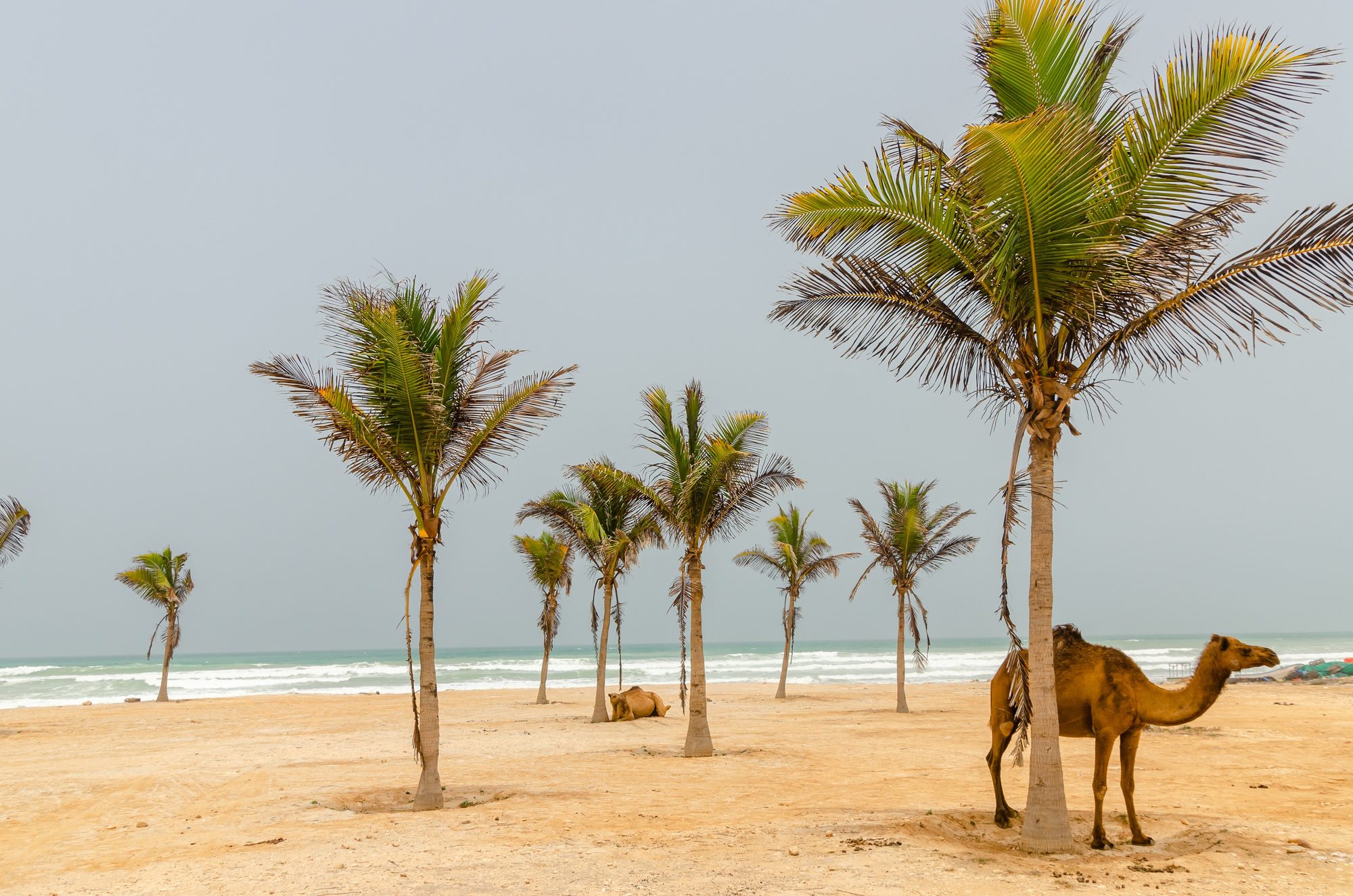
- Al Mughsail beach — A long white-sand beach about 45 km west of Salalah, with shaded picnic shelters. In winter the water is often clear. Swim only when the sea is calm, and dress modestly. The lagoon behind the beach is a nature reserve for birds.
- 15Marneef Cave and the blowholes — A large rock overhang above the sea at the western end of the beach; follow the path from the car park. Holes in the rock below throw up spray when the sea is rough, best at high tide. In winter the sea is often calm, so the blowholes may be quiet.
- Fazayah Beach (optional) — A remote beach below high cliffs, about half an hour west of Al Mughsail: about 15 km on the N9, then a graded track of about 6 km down the cliff. Ask us whether you may use the track before you go, and drive it in daylight. If you drive onto the sand, check the tide first and park above the high-tide line. There are no shops: take shade, food and water. A few kilometres past the Fazayah turn-off the N9 reaches an army checkpoint, so carry your passports and turn back there. Do not continue towards the Yemen border: it is closed, and our cars may not leave Oman.
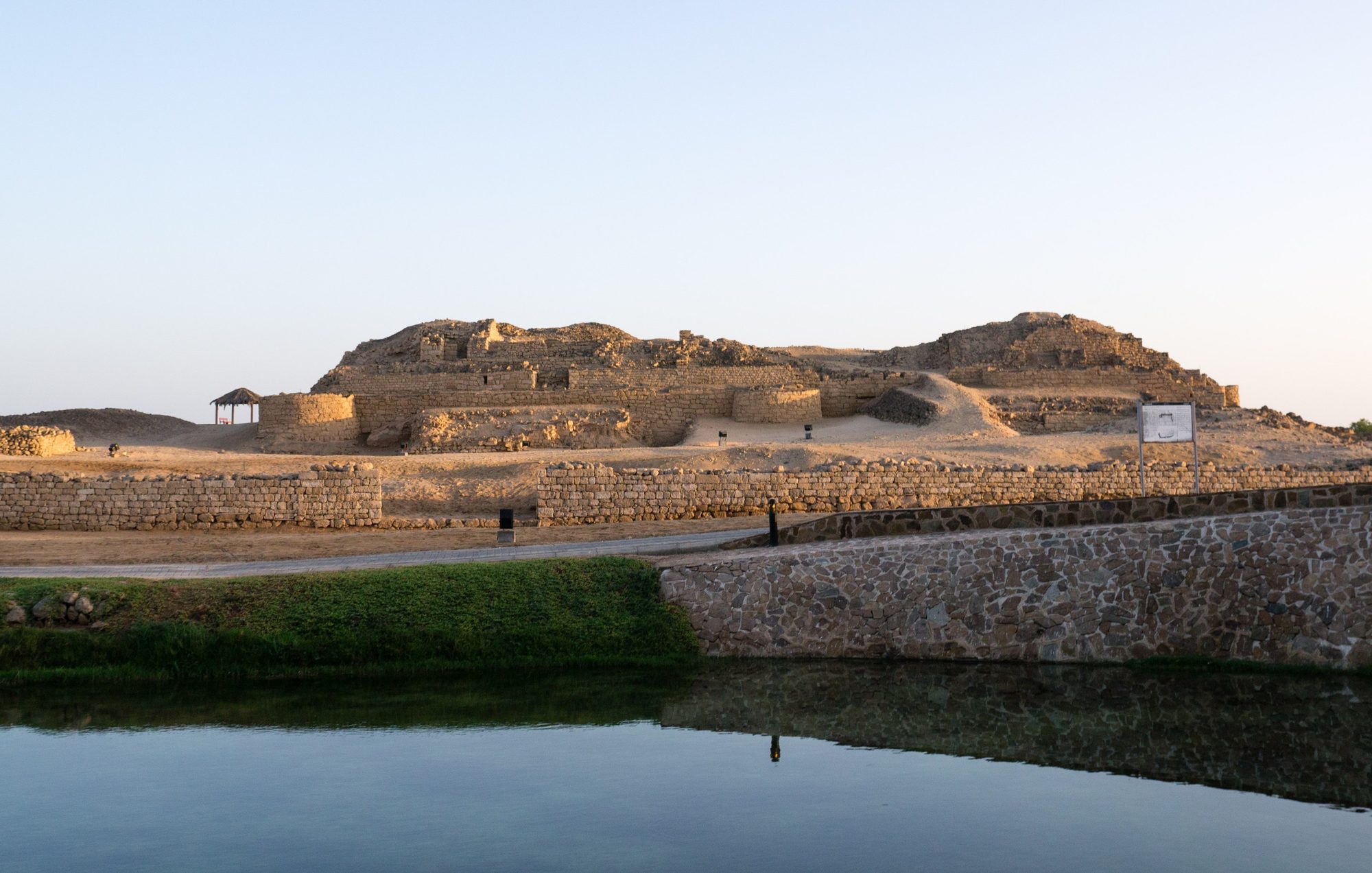
- 16Al Baleed Archaeological Park and the Museum of the Frankincense Land — The ruins of Zafar, a port city from about the 6th to the 17th century, on the coast of Salalah, part of the UNESCO Land of Frankincense. The museum has a history hall and a maritime hall. Opening hours differ between sources, but both published schedules include every day from 16:00 to 20:00. Entry was about OMR 2 to 3 per adult, including the museum, and some reports say only cards are accepted; check before you go.
Where to sleep: Your hotel or apartment in Salalah.Tip: Go to Al Baleed after 16:00: both published schedules show it open then on every day of the week, and the light is softer.Photo: Juozas Šalna (Flickr: pukomuko) · CC BY 2.0
Day 13
A slow day in Salalah- Al Haffa souq
- Salalah beaches
- Supermarkets and fuel
Details
After the long coast road and before two long days on the N3, rest. Sleep in, walk on the beach and shop for frankincense in Al Haffa souq. In the afternoon, get the car ready for the drive north: fill the tank, check the tyre pressure, refill the water and buy food for two days.
- Al Haffa souq — The market near the sea, known for frankincense, incense burners, halwa and clothes. Shops open until midday and again from about 16:00 until late. Parking costs money at certain times.
- Salalah beaches — Long sandy beaches at Al Haffa and Al Baleed. There are no sun loungers for hire, so bring a blanket. Sunbathing in swimwear is not considered appropriate on public beaches: cover up between swims. The sea off Salalah has strong currents and the seabed drops steeply, so swim only when the sea is calm and stay close to the shore.
- Supermarkets and fuel — Large supermarkets and many fuel stations in town. Buy food and drinking water for at least two days.
Where to sleep: Your hotel or apartment in Salalah.Tip: Check the tyres for cuts and set the pressure on the driver's door sticker before the N3. If a warning light comes on, call us before you leave Salalah.Photo: Krzysztof Ziarnek, Kenraiz · CC BY-SA 4.0
Day 14
Salalah to Wadi Dawkah and Haima on the N3- 17Wadi Dawkah
- Thumrait
- Qitbit
- 18Haima
Details
The longest day of the trip. Leave Salalah by 7:00. The N3 climbs over the mountains behind the city. About 45 km north of Salalah, stop at Wadi Dawkah to see the frankincense trees. After Thumrait the road crosses a flat, empty gravel plain for hundreds of kilometres. Take a break every two hours, and fill up whenever you pass a station and the tank is half empty. Reach Haima, the capital of Al Wusta, by mid-afternoon.
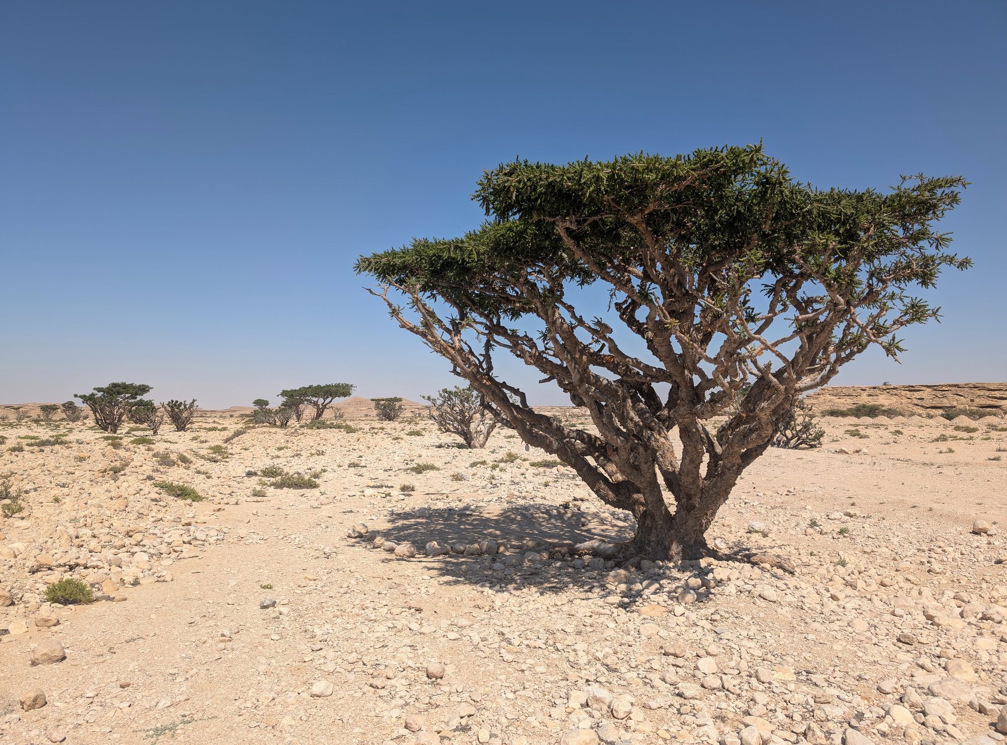
- 17Wadi Dawkah — A protected valley about 45 km north of Salalah, just off the N3, and part of the UNESCO Land of Frankincense. More than 1,200 old frankincense trees grow here, and thousands of young trees have been planted along the valley. There is a car park, an information panel and toilets, and entry is free. Do not cut the bark or take the resin.
- Thumrait — A town about 80 km from Salalah with several fuel stations. Fill the tank here.
- Qitbit — A fuel station on the N3 about 275 km from Salalah. Between Thumrait and Haima, OpenStreetMap shows stations about 70 km north of Thumrait, at Qitbit, near Muqshin and about 95 km before Haima; the longest gap is about 120 km. Remote stations can be closed, so never pass one with less than half a tank.
- 18Haima — The capital of Al Wusta, a small town at a crossroads of desert roads, with several fuel stations, shops and a few simple hotels and motels.
Where to sleep: Option 1: one of the simple hotels or motels in Haima; check before you go. Option 2: a desert camp north of Haima, only if you arrive well before sunset. Leave the N3 only on an existing track, and ask us if you are not sure about one. Stop on firm gravel right next to the track, out of sight of the road, houses, camel camps and fenced oil and gas sites. Do not drive cross-country or onto soft sand. Take all rubbish with you.Tip: Do not drive the N3 after dark. Camels walk onto the road, there are no lights, and between Thumrait and Haima you share a single carriageway and roadworks with lorries. If you are tired, stop for the night in Haima rather than push on.Photo: dconvertini (Domenico Convertini), via Flickr · CC BY-SA 4.0
Day 15
Haima to Adam and Nizwa- Fuel north of Haima
- Adam
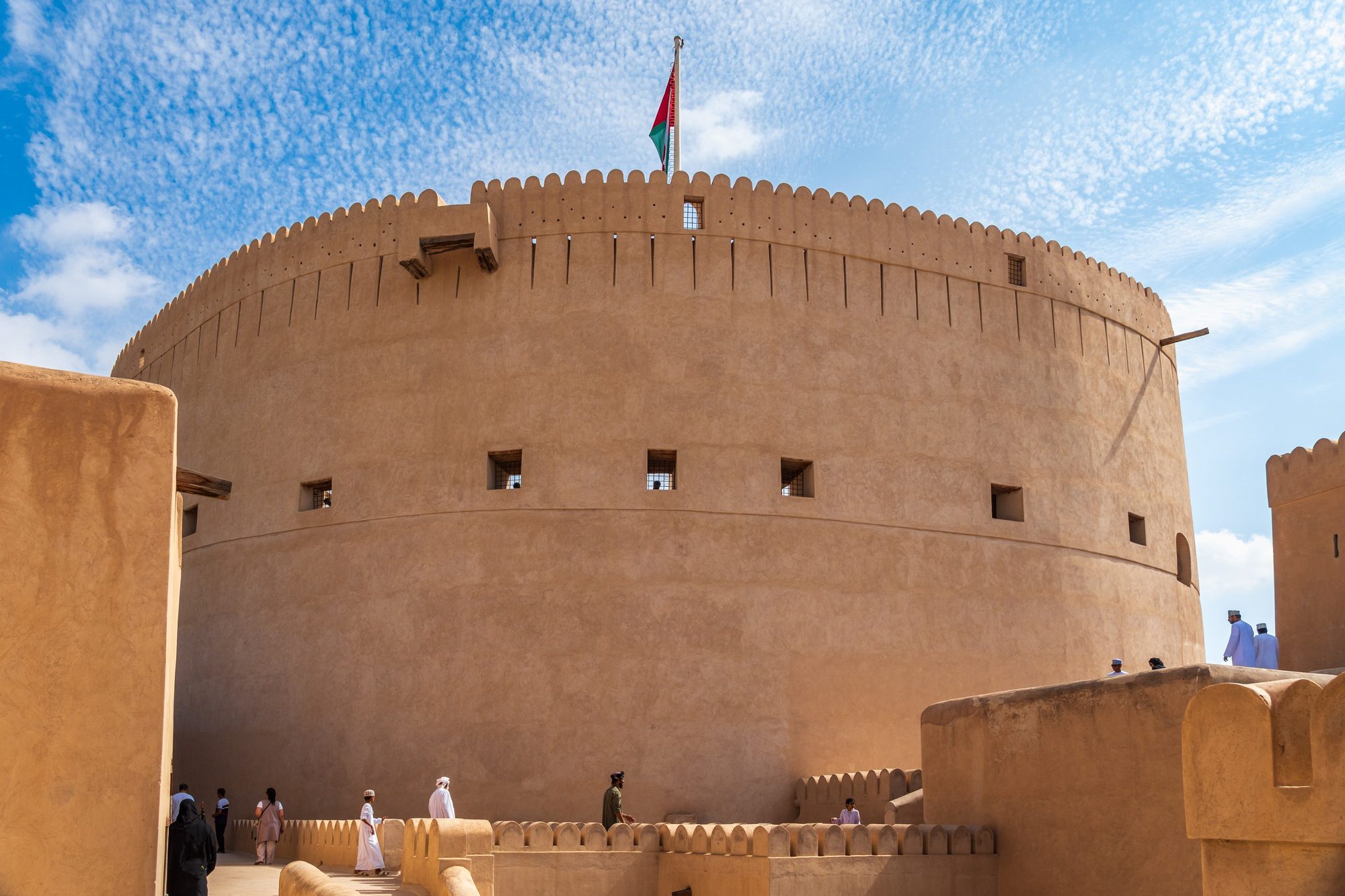
- 19Nizwa Fort and souq
Details
Start early again. North of Haima the gravel plain goes on for a long time. Closer to Adam, low hills appear, and then the Hajar Mountains. Adam, the first oasis town after the desert, has palm gardens watered by aflaj and old mud-brick quarters. From Adam, Nizwa is less than an hour away. Spend the afternoon at Nizwa Fort and in the souq.
- Fuel north of Haima — OpenStreetMap shows stations about 105 km and 200 km north of Haima, then in Adam, about 320 km from Haima. Fill up at each one.
- Adam — An oasis town at the southern gate of the Dakhiliyah region, on the Nizwa–Salalah road, with palm gardens, aflaj and old mud-brick quarters. Fuel and shops.
- 19Nizwa Fort and souq — Climb the round tower of the 17th-century fort, 34 m high, for a view over the palm oasis. The fort opens daily at 8:00, with a midday break on Fridays from about 11:30 to 13:30. Closing time is given as 18:00 or 20:00 depending on the source, so check before you go. Entry is about 5 OMR per adult (2025-2026). Then walk through the souq next to the fort.
Where to sleep: We suggest a hotel or guesthouse in Nizwa tonight, after two long desert days. Book ahead for Thursday and Friday nights.Tip: If tomorrow is a Friday, start at the goat market in the souq: farmers trade goats and cattle in the auction ring from about 6:30 to 9:30. Arrive by 7:00 and dress modestly, then drive on to Jabrin and Bahla.Photo: Christoph Strässler · CC BY-SA 2.0
Day 16
Nizwa to Jabrin, Bahla, Al Hamra, Misfat and Jebel Shams- 20Jabrin Castle
- Bahla Fort
- Al Hamra
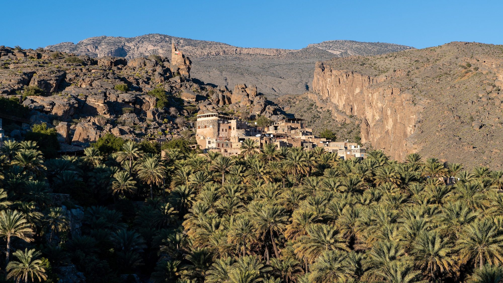
- 21Misfat al Abriyeen
- Wadi Ghul viewpoints
Details
Be at Jabrin Castle when it opens at 7:30, then visit Bahla Fort, about 10 km away. Drive north to Al Hamra and Misfat al Abriyeen, two old villages above palm gardens. Fill the tank at the Shell station in Al Hamra: there is no fuel station on Jebel Shams. The mountain road climbs past Ghul in steep bends. Near the top, parts of the road are graded gravel, and a two-year upgrade of the road started in January 2026, so expect roadworks, diversions and changing surfaces. Arrive before sunset, which from November to January is between about 17:25 and 17:55.
- 20Jabrin Castle — A palace completed in 1675 for Imam Bil'arab bin Sultan, with painted wooden ceilings, carved doors and the Sun and Moon room. Open daily 7:30 to 21:00; entry about 3 OMR per foreign adult, check before you go.
- Bahla Fort — The first site in Oman on the UNESCO World Heritage list (1987): a large mud-brick fort above a palm oasis, inside an old town wall more than 12 km long. The official site gives 8:00 to 19:00 daily, but visitors in 2025 reported closing at 16:00 and Friday mornings only, so arrive early. Entry is OMR 4–5 per adult; check before you go. Bahla is also known for its potters.
- Al Hamra — The old quarter is one of the best-preserved mud-brick quarters in Oman, with rows of houses several storeys high. In Bait al Safah, a restored family house run as a small museum, local women show how Omani bread, coffee and other traditional products are made.
- 21Misfat al Abriyeen — Park at the village entrance, or in the car park further back when it is full, and walk down the lanes beside the falaj to the gardens. Allow 1 to 2 hours. Cover shoulders and knees, do not pick fruit, do not swim in the falaj pools, and stay out of private houses and the mosque.
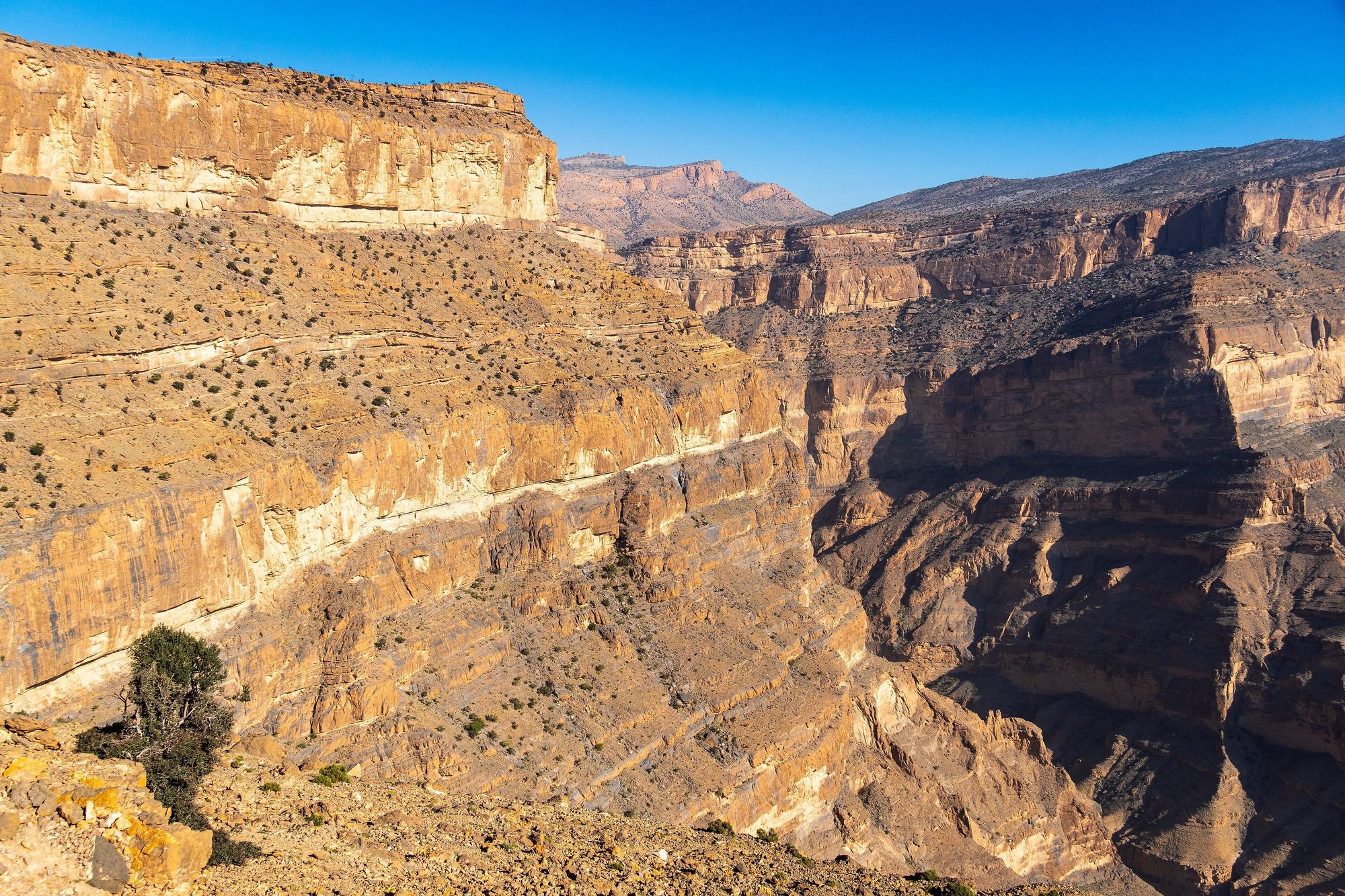
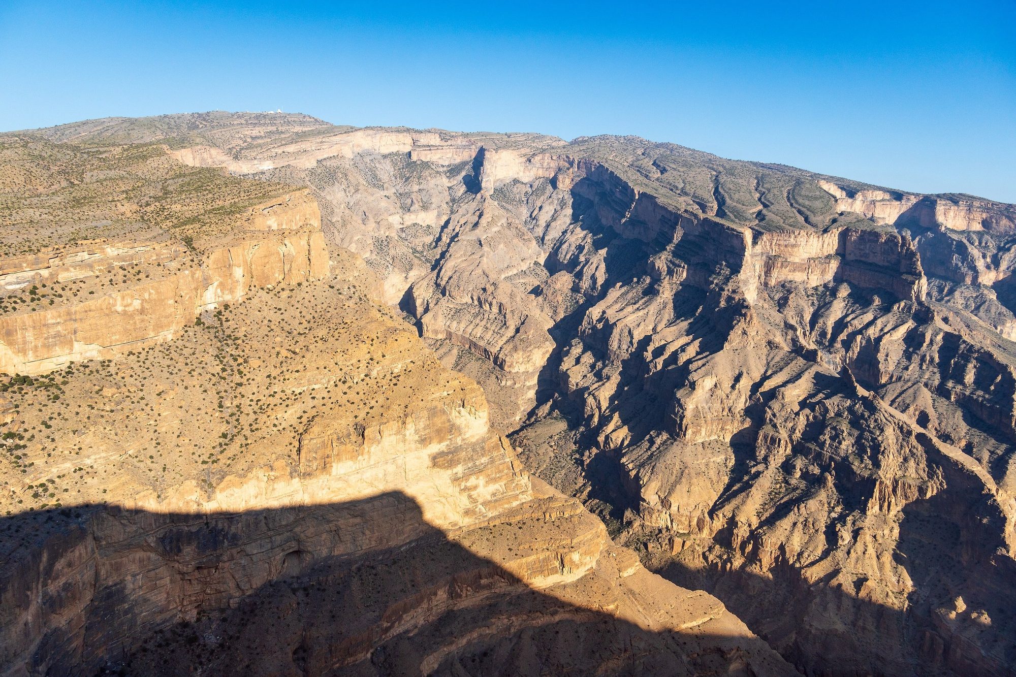
- Wadi Ghul viewpoints — Stop near Ghul to see the ruined old village on its rocky hill at the mouth of the canyon. Higher up, several parking areas look down into the gorge, which is about 1,000 m deep.
Where to sleep: On the canyon rim between the Jebel Shams Resort and Al Khitaym, where the road ends, or on the open plateau before the resorts. Park on a flat spot well back from the edge and away from village houses. There is no water and no free toilet; the resorts and the walking trail have small paid toilets. Keep food and rubbish inside the car, because goats roam the rim and eat whatever is left out. Building work for a new visitor area is under way on the mountain, so some spots may be fenced off. The rim is windy, and from December to February the nights can drop to around or below 0 °C. You stay here two nights.Tip: Leave Misfat by about 15:00: the drive up to the rim takes about 1.5 hours, and you want daylight to choose your spot.Day 17
Jebel Shams: the Balcony Walk- 22Balcony Walk (W6)
- Canyon rim viewpoints
Details
A day on foot. Watch the early light on the canyon walls, then start the Balcony Walk early, while it is still cool. Back at camp, rest in the afternoon, dry the tent and sort the food. At sunset, walk to the edge of the rim and look down into the canyon.
- 22Balcony Walk (W6) — The signposted path starts at Al Khitaym and follows a ledge along the canyon wall to the abandoned village of As Sab. It is about 8 km there and back. You lose a few hundred metres of height on the way out (sources give 200 to 350 m) and climb it again on the way back. Allow 3 to 5 hours. Most of the path has no railings, so it is not for people with vertigo. The small toilets at the start and along the path cost a few hundred baisa (about 0.3 to 0.5 OMR), so carry coins.
- Canyon rim viewpoints — Several parking areas along the rim road look down into the gorge of Wadi Ghul, which is about 1,000 m deep. There are no railings: stay well back from the edge, especially with children.
Where to sleep: The same spot on the rim. Keep food and rubbish inside the car, because goats roam the rim and eat whatever is left out.Tip: Start the walk by 8:00, while the path is still in shade, and carry at least 2 litres of water per person.Day 18
Jebel Shams to Birkat al Mawz and Jebel Akhdar- Birkat al Mawz
- 23Wadi Bani Habib
- Sunset over the terraces
Details
Drive down the mountain in a low gear in the morning. Pass Nizwa and continue to Birkat al Mawz, an oasis town at the foot of Jebel Akhdar. About 7 km up the D518 is the police checkpoint. Only 4x4 vehicles may continue, so have your passports, driving licences and the car registration card (mulkiya) ready. From the checkpoint, the road gains about 1,200 m in some 30 km to the Saiq plateau, at around 1,900 to 2,000 m. Spend the afternoon at Wadi Bani Habib and watch the sunset over the terraces.
- Birkat al Mawz — Walk through the palm gardens and the ruined old quarter below the mountain. Falaj Al Khatmeen, one of the five aflaj (water channels) on the UNESCO World Heritage list, runs through the courtyard of Bayt Ar-Ridaydah, a 17th-century fortified house that is open to visitors. Buy fuel, food and water here before the climb.
- 23Wadi Bani Habib — The D518 ends here. From the car park, stone steps lead down into a green valley with walnut and other fruit trees and the ruins of an abandoned village of mud and stone houses. Allow 1 to 1.5 hours there and back.
- Sunset over the terraces — Diana's Point is inside the grounds of the Anantara resort, but there is a free viewpoint with a similar view over the terraces next to the Layali Al Jabal restaurant nearby.
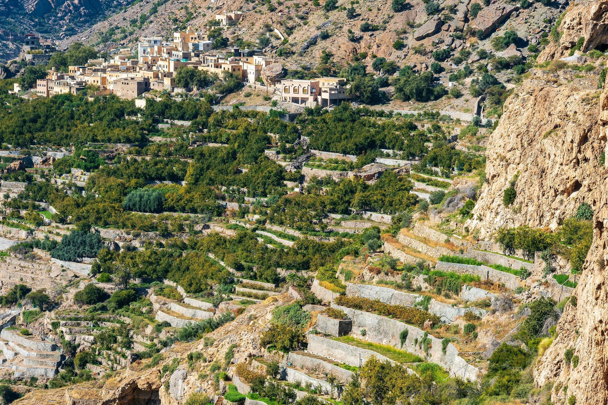
Where to sleep: Open public ground on the plateau, well away from houses, farms, terraces and hotels. Several popular spots with views into the gorges are on the rocky western part of the plateau, towards the Alila hotel. Park on a flat gravel spot and do not drive over plants. Jebel Akhdar became a UNESCO biosphere reserve in 2025, and part of the mountain is the Al Jabal Al Akhdar Scenic Reserve, where camping or staying overnight needs a permit from the Environment Authority. Respect any signs and fences, and if you are not sure, ask at your hotel or at the checkpoint. Take all rubbish with you and cook only on the stove. From December to February the nights are cold, sometimes close to freezing.Tip: Fill the tank in Birkat al Mawz. There is only one fuel station on the plateau (Al Maha, in Saiq), and the climb uses more fuel than usual.Photo: Diego Delso · CC BY-SA 4.0
Day 19
Jebel Akhdar villages and back to Muscat- Al Aqur, Al Ayn and Ash Shirayjah (path W18b)
- Mutrah corniche and souq
Details
Walk the village path along the edge of the gorge early, before the sun is high. Then drive down to Birkat al Mawz in a low gear and take the N2 back to Muscat. Check in at your hotel and spend the evening on the Mutrah corniche and in the souq, which is liveliest after dark.
- Al Aqur, Al Ayn and Ash Shirayjah (path W18b) — A signposted path links three villages on the edge of the gorge, about 4 km one way, with many steps and some rocky parts. The terraces grow pomegranates, walnuts and the damask roses used for rosewater, picked from about mid-March to early May. Walk the first section and return, or allow 3 to 4 hours for the full path there and back.
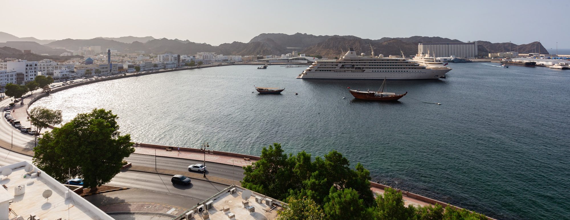
- Mutrah corniche and souq — The old harbour front of Muscat, with a covered souq of narrow lanes behind it. In 2025-2026 the souq was open Saturday to Thursday from 9:00 to 13:00 and 16:00 to 23:00, and on Friday from 9:00 to 11:00 and 16:00 to 23:00; hours change during Ramadan and on public holidays. Dress modestly.
Where to sleep: No camp tonight. Book a hotel in Muscat. In Muscat Governorate, camping is allowed only at sites set by the municipality, away from beaches and homes, and stays over 48 hours need a municipal permit.Tip: On the long descent from Jebel Akhdar, use a low gear (L or manual mode in an automatic) and let the engine hold the car. Do not keep your foot on the brake: brakes overheat on long steep roads. The road has escape lanes for vehicles whose brakes fail.Day 20
Muscat: the Grand Mosque, then return the car- 24Sultan Qaboos Grand Mosque
- Return the car
Details
On the last morning, visit the Sultan Qaboos Grand Mosque, about 13 km from the airport. Then return the car at the airport or at your hotel. Leave time to empty the car and hand back the camping kit to our team.
- 24Sultan Qaboos Grand Mosque — Non-Muslim visitors are admitted from Saturday to Thursday in the morning, from about 8:00 or 8:30 to 11:00, and not on Fridays. An entry fee of about OMR 8 was introduced in January 2025. Some 2026 guides say it was withdrawn after a few weeks and entry is free, but the national tourism site still lists OMR 8, so check before you go. Cover shoulders and knees (men in long trousers) and wear loose clothing; women must also cover their hair.
- Return the car — At Muscat International Airport or at your hotel in Muscat.
Where to sleep: No camp tonight. The trip ends in Muscat.Tip: If Day 20 is a Friday, the mosque is closed to visitors. Walk the Mutrah corniche in the morning instead.
Which car?
On a 3,500 km trip comfort matters. The Toyota Land Cruiser Prado (OMR 75 per day) is the better fit: it is quieter and more comfortable at highway speed on the long A11 and N3 days, and it has more space for food and water for several days. Its Family tent sleeps 2 adults + 2 children, or 3 adults. The Jeep Wrangler 4-door (OMR 55 per day) also handles every part of this route, including the sand tracks, the Sugar Dunes sand and the Jebel Shams gravel, and suits a couple who want a lower price.
Practical tips
Read more
- Long days and fuel: Duqm to Salalah is about 640 km on the A11 and Salalah to Nizwa about 880 km on the N3. Here the coast road takes four days (Days 8 to 11) and the N3 two (Days 14 and 15), but Day 9 and Day 14 are still long. South of Al Ashkharah and on the N3, stations can be up to about 130 km apart, and from Dhahar to Haitam via Ras Madrakah there is none for about 150 km. A remote station can be closed. Never pass a station with less than half a tank.
- Our rules: in daylight only, you may drive on existing gravel, rocky and sand tracks, open dunes such as the Wahiba Sands and the Sugar Dunes, and beaches. Never drive off-road after dark. Drive on a beach only where it is allowed: never in the Ras al Hadd–Ras al Jinz turtle reserve, and never where signs or the authorities forbid it, as on some beaches in Muscat. Driving in wadis is not allowed: not in a wadi bed and not on a track through or along one. Paved roads that cross or run beside a wadi are fine, and so is driving to a wadi's car park to walk in. Never drive into water or flooded roads, and never park or camp in a wadi bed. If you break these rules, you pay the full cost of any damage. If you are not sure about a track, ask us. Our cars may not leave Oman: do not drive into the UAE or Yemen. The border with Yemen is closed, and west of Al Mughsail there is an army checkpoint, so carry your passports in Dhofar.
- Sand and tyres: before sand tracks, dunes or a sandy beach, lower the tyres to about 18–20 psi (1.2–1.4 bar), and use low range in soft sand. Drive slowly and steadily, and do not stop on soft sand. Pump the tyres back up with the compressor before the asphalt. If you get stuck, stop at once, do not spin the wheels, and use the recovery boards or call us. If you have never driven on sand, start with small dunes or take a local guide, and keep off steep slip faces. On a beach, check the tide times first and drive at low tide.
- Heat and cold: from November to March, Salalah has average highs of about 27 to 31 °C, and the coast is mild. On Jebel Shams and Jebel Akhdar, nights from December to February can be close to 0 °C. Bring a warm jacket, a hat and warm socks as well as summer clothes.
- Water and food: carry at least 5 litres of drinking water per person per day, plus a reserve in the car. Between Duqm and Salalah and along the N3, shops are few and small. Buy food for three days in Duqm and for two days in Salalah.
- Night driving: avoid driving after dark outside towns. Camels and goats walk onto the roads, most rural roads have no lights, and between Thumrait and Haima the N3 is mostly a single carriageway shared with lorries, with roadworks.
- Tickets: book the Ras al Jinz turtle tour in advance (OMR 12 per tourist adult on the reserve's website in October 2026). Other fees in 2025-2026 reports: Wadi Shab boat about OMR 1 return, Nizwa Fort about OMR 5, Bahla Fort OMR 4–5, Jabrin Castle about OMR 3, Sumhuram OMR 2 in older listings and Al Baleed about OMR 2 to 3. The Grand Mosque fee of about OMR 8 may have been withdrawn: see Day 20. Wadi Bani Khalid and Wadi Dawkah are free. Prices change: check before you go and carry cash in small notes.
- Dress code: cover shoulders and knees in towns, villages, forts and souqs, and swim in a T-shirt and shorts at the wadis and on public beaches. Ask before you photograph people. During Ramadan (expected around 8 February to 9 March 2027; the exact dates depend on the moon), eating, drinking or smoking in public during the day is against the law for everyone, including non-Muslims.
- Camping: keep away from villages, farms and private land, and never camp in a wadi bed, because a storm far away can send a flood down a dry valley. Do not camp on the turtle nesting beaches of Ras al Hadd and Ras al Jinz or at the khawrs (lagoons) of the Salalah coast, which are nature reserves. In Muscat Governorate you may camp for up to 48 hours without a permit. In the Jabal Samhan Nature Reserve and the Al Jabal Al Akhdar Scenic Reserve, camping or staying overnight needs a permit. Take all rubbish with you, cook on the gas stove, and never cut or burn trees or bushes.
- Maps and road numbers: download offline maps of the whole route before you leave Muscat; the mobile signal can be weak in the wadis, the mountains and the empty south. Oman renumbered its main roads in 2019, so maps and signs may show the new numbers (A2, N4, A8, A11, N3, N2) or the old ones (Route 17, 23, 32, 41, 49, 31, 15). Ignore sat-nav shortcuts onto gravel roads.
Questions
How many days do you need for a road trip around Oman?
For a loop that includes Salalah, plan at least two to three weeks. Muscat and Salalah are about 1,000 km apart by the shortest road. On this route, the coast road from Duqm to Salalah and the N3 back to Nizwa alone take six days. In 20 days this route covers the coast, the Wahiba Sands, the south coast, Dhofar and the mountains, with time to rest. With less time, choose one of our 3 to 5 day routes from Muscat.
How far is Salalah from Muscat by car?
About 1,000 km on the inland road, the N2 and the N3 via Nizwa, Adam, Haima and Thumrait: about 11 hours of driving without stops. The coast road via Duqm is longer but much more varied. This route drives south along the coast and returns on the N3, with overnight stops on both.
Is the coast road from Duqm to Salalah paved?
Yes. The A11 Duqm–Hasik–Salalah road is asphalt all the way, about 640 km. Villages are far apart and camels often walk on the road. There are fuel stations in Dhahar, Haitam, Al Kahil, Al Lakbi, Shalim, Ash Shuwaymiyah, Hasik, Sadah and Mirbat; fill up whenever the tank is half empty. Side tracks are a different matter: our cars may not drive in wadis, and tracks to beaches are for daylight only. Ask us which tracks you may use.
When is the best time to visit Salalah?
It depends on what you want. The khareef, the monsoon from June to September, turns the hills green and brings mist, drizzle and many visitors. From October to April Salalah is dry and warm, with average highs of about 27 to 32 °C, and the sea is usually calmer. This is also our rental season. The waterfalls are much smaller then, but Wadi Darbat still has water in its pools.
Can I drive a rental car from Oman to the UAE or Yemen?
Not with our cars: our rental terms do not allow you to leave Oman. The land border with Yemen is closed in any case. This route stays inside Oman all the way, from Muscat to Salalah and back.
Where can you camp in Dhofar?
Wild camping on public land is common in Oman, but near Salalah you need care. The khawrs, the coastal lagoons such as Khor Rori and Al Mughsail, are nature reserves where camping or staying overnight needs written permission. The public viewpoint on the Jebel Samhan road is a popular camp spot, but further east the road enters the Jabal Samhan Nature Reserve, where camping or staying overnight also needs a permit. Many visitors, as on this route, sleep in a hotel or apartment in Salalah. Take all rubbish with you and do not light fires on vegetation.
Do I need to book the turtle tour at Ras al Jinz?
Yes. Book before you travel, online, by phone or by email; the contacts are on the reserve's official website. At night you may go onto the nesting beaches of the turtle reserve only with a registered guide, and the guided tours at Ras al Jinz are how visitors do this. The night tour starts at 21:00 (arrive by 20:30) and the dawn tour at 5:00 (arrive by 4:45); times can change with the season. In October 2026 the reserve's website listed OMR 12 per tourist adult and OMR 6 per child aged 6 to 12. Check before you go.
Ready to go?
Choose your dates. We hand over the car with the rooftop tent and the full camping kit at Muscat airport or at your hotel in Muscat.
More itineraries
 Dunes and wadisWahiba Sands · Wadi Bani Khalid · Sur
 The mountain loopNizwa · Jebel Shams · Jebel Akhdar
 The south coastSur · Ras al Jinz · Sugar Dunes
 One week in OmanCoast · Desert · Mountains
 The grand loopCoast · Wahiba Sands · Jebel Shams
 Two weeks in OmanCoast · Desert · Old towns · Mountains
 A month in OmanCoast · Desert · Dhofar · Mountains
Oman travel guides
Distances and driving times are approximate. Check road conditions, tides, weather and opening times before you go. Photos are licensed stock photos of the places, not of our cars.