
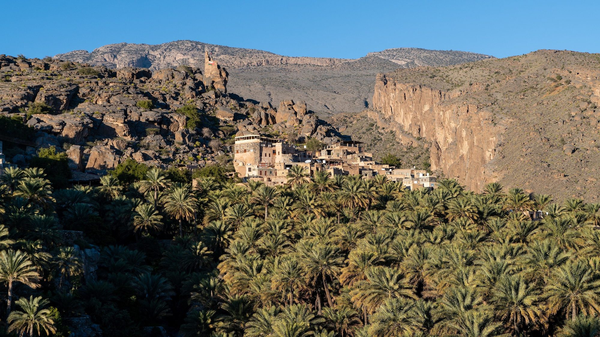
Oman in 14 days: a two-week 4x4 road trip from Muscat
Coast · Desert · Old towns · Mountains
Photo: Christoph Strässler · CC BY-SA 2.0
Two weeks is a good length for northern Oman: enough time for the coast, the desert, the mountains and the old towns without rushing. This 14-day itinerary from Muscat starts with two nights by the sea at Fins, for Bimmah Sinkhole, Wadi Shab and Wadi Tiwi, then follows the coast to Sur and the turtles of Ras al Jinz. Inland you swim in Wadi Bani Khalid and spend two nights in the Wahiba Sands, now officially named the Sharqiya Sands. In the Hajar Mountains you stay two nights on the Saiq plateau of Jebel Akhdar, a night in Nizwa and two nights on the rim of the Wadi Ghul canyon below Jebel Shams. The last days take you to the forts of Bahla, Jabrin and Ibri, the stone tombs of Bat and Al Ayn from the 3rd millennium BC, over the mountains to Rustaq and Nakhal, and back to Muscat.
Read more
The pace is easy. No day has more than about 230 km of driving, almost all on paved roads, and there are four two-night stops: at Fins, in the Wahiba Sands, on Jebel Akhdar and on Jebel Shams. The only sand driving on the route is a marked track of 5–15 km to your desert camp. The mountain roads are long and steep: a police checkpoint at the foot of Jebel Akhdar lets only 4x4 vehicles continue, and near the top of Jebel Shams there are gravel sections and roadworks. In daylight you may also drive on the dunes, and on beaches where the law allows it, but never in a wadi bed or on a wadi track.
You sleep in the rooftop tent on about nine nights. A hotel night comes about once a week, in Nizwa and in Muscat, and the nights in Ibri and Rustaq can be in a hotel too. We count rental days as the nights between the pick-up date and the return date, so this trip is a 13-day rental. If you start on a Thursday, Day 9 is a Friday, the day of the goat market in Nizwa, and Day 14 is a Wednesday, when the Grand Mosque is open to visitors in the morning. Dhofar and Salalah are not included: they are about 1,000 km from Muscat each way.
All trip details
Photos
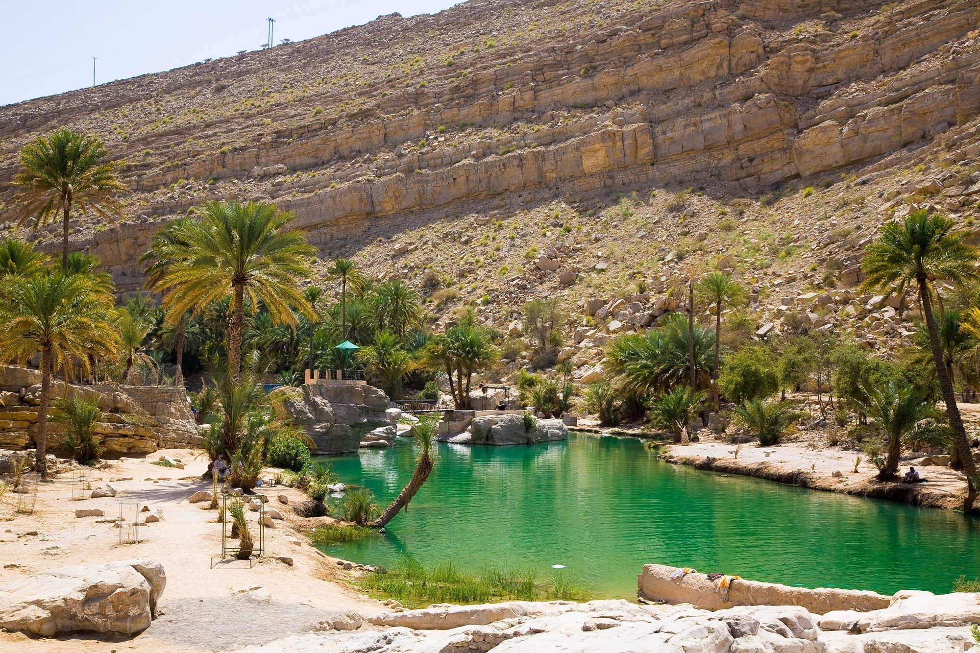
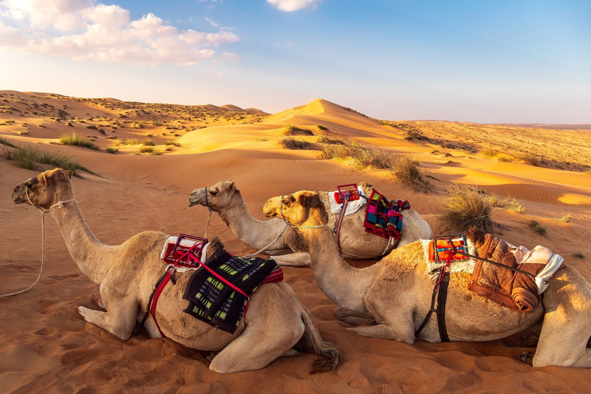
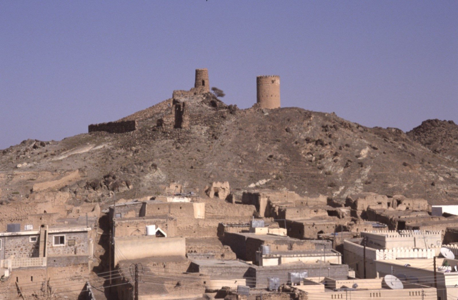
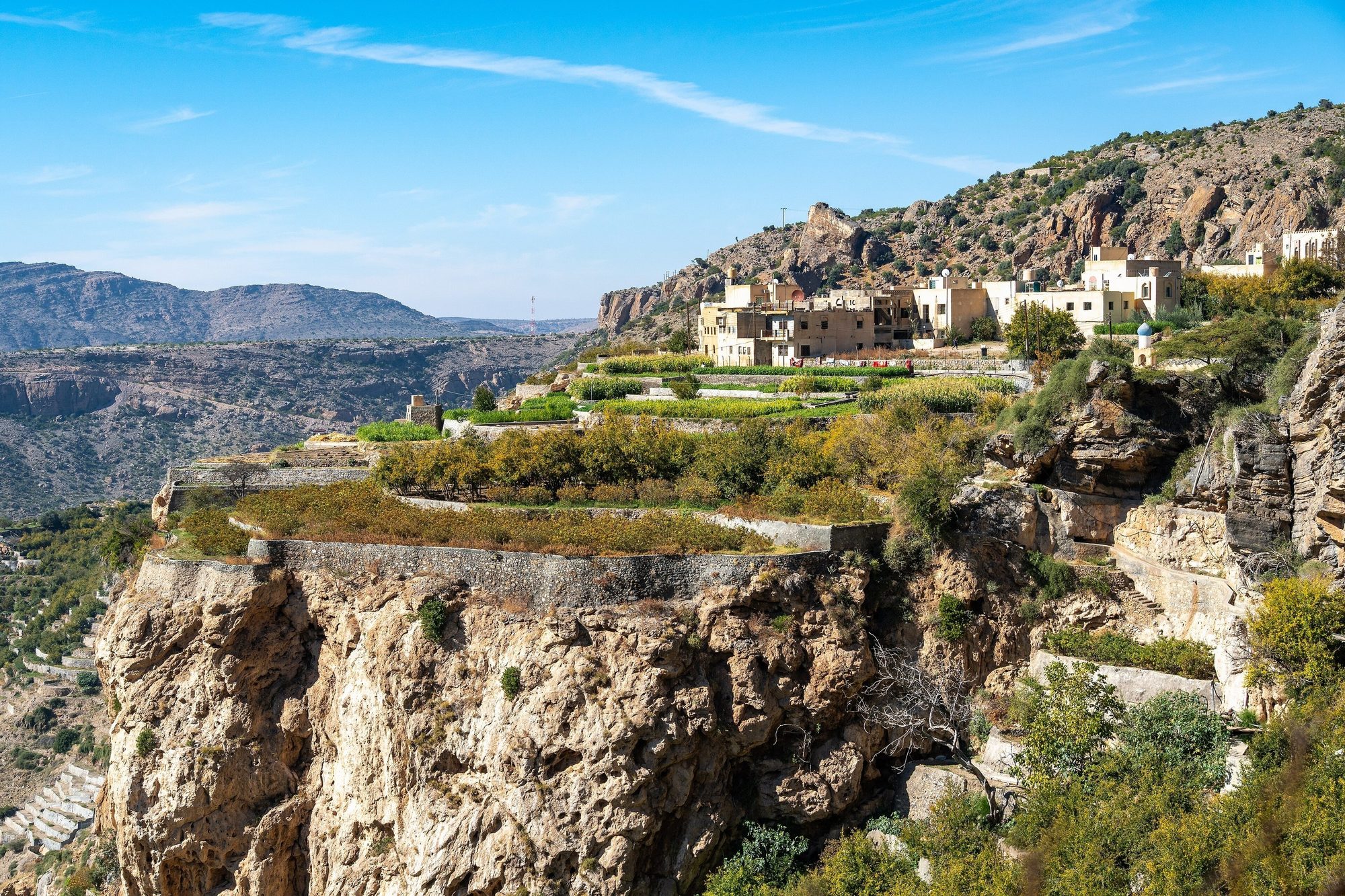
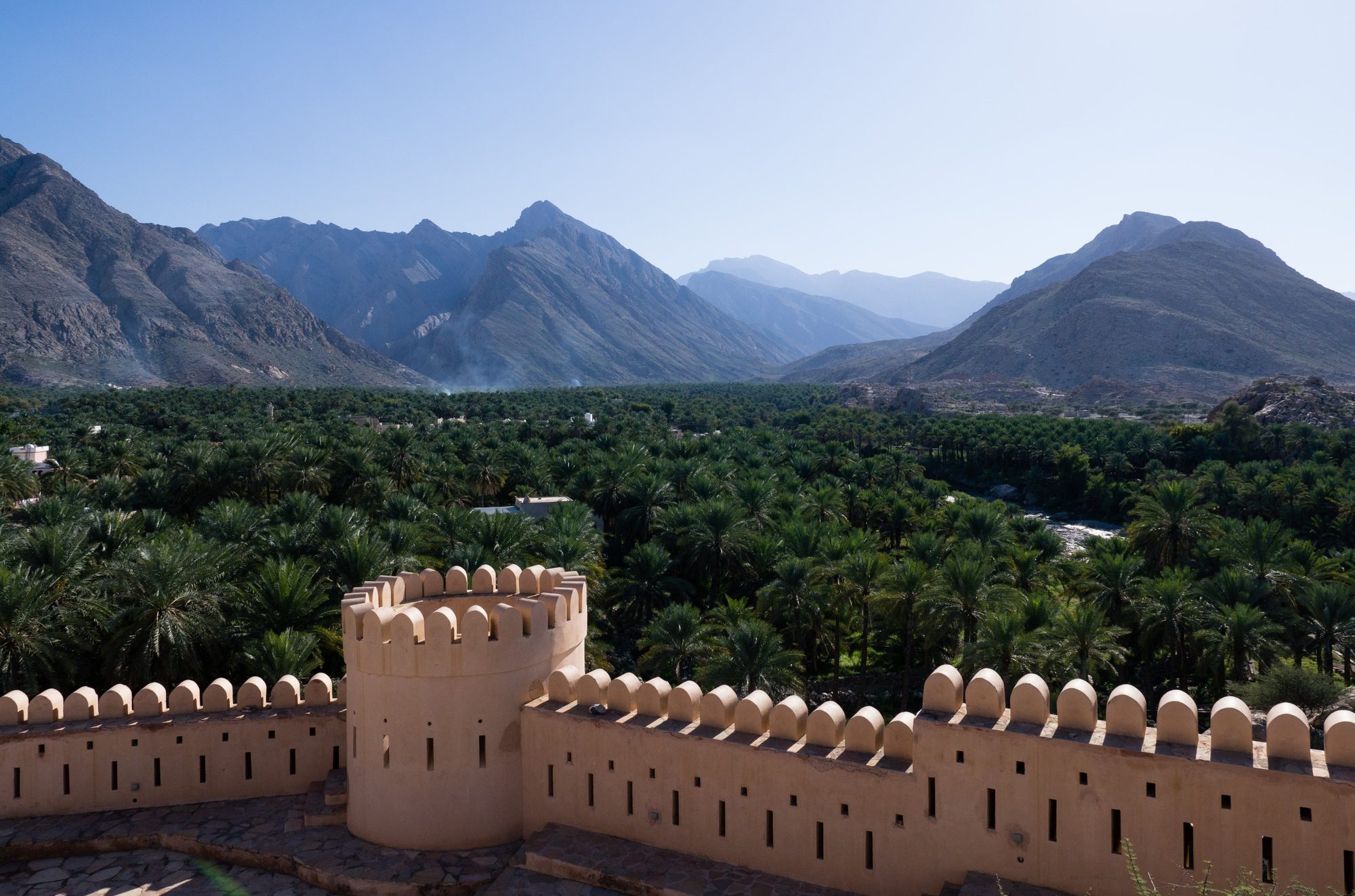
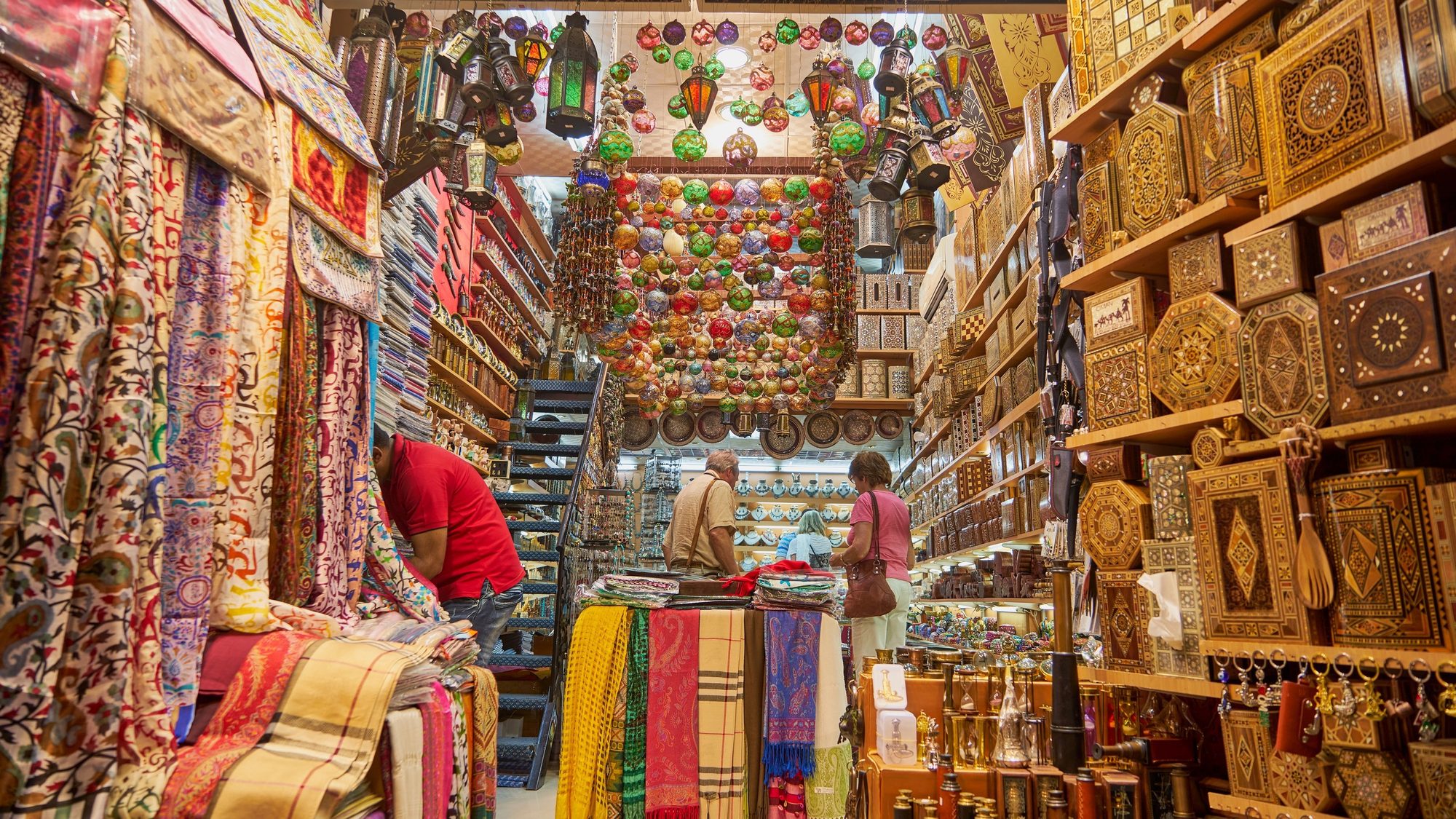
Route map
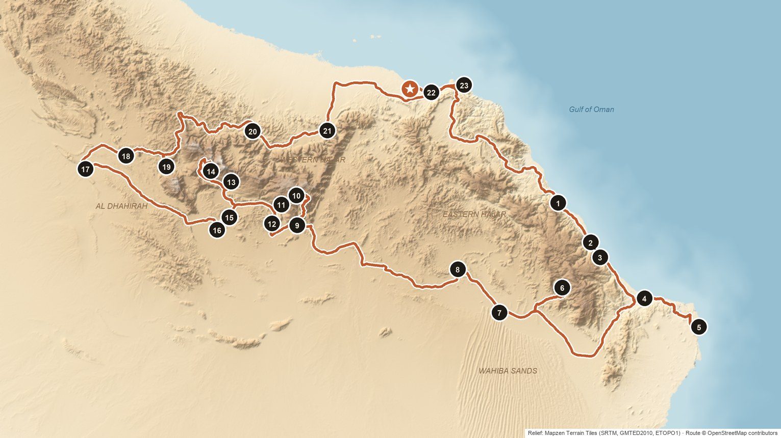
- ★Start and end: Muscat International Airport or your hotel in Muscat
- 1Bimmah Sinkhole (Hawiyat Najm Park) · Day 1
- 2Wadi Shab · Day 2
- 3Wadi Tiwi · Day 2
- 4Sur dhow yard and Al Ayjah lighthouse · Day 3
- 5Ras al Jinz Turtle Reserve · Day 3
- 6Wadi Bani Khalid · Day 4
- 7Al Wasil · Day 4
- 8Ibra · Day 6
- 9Birkat al Mawz · Day 6
- 10Al Aqur, Al Ayn and Ash Shirayjah (path W18b) · Day 7
- 11Wadi Bani Habib · Day 7
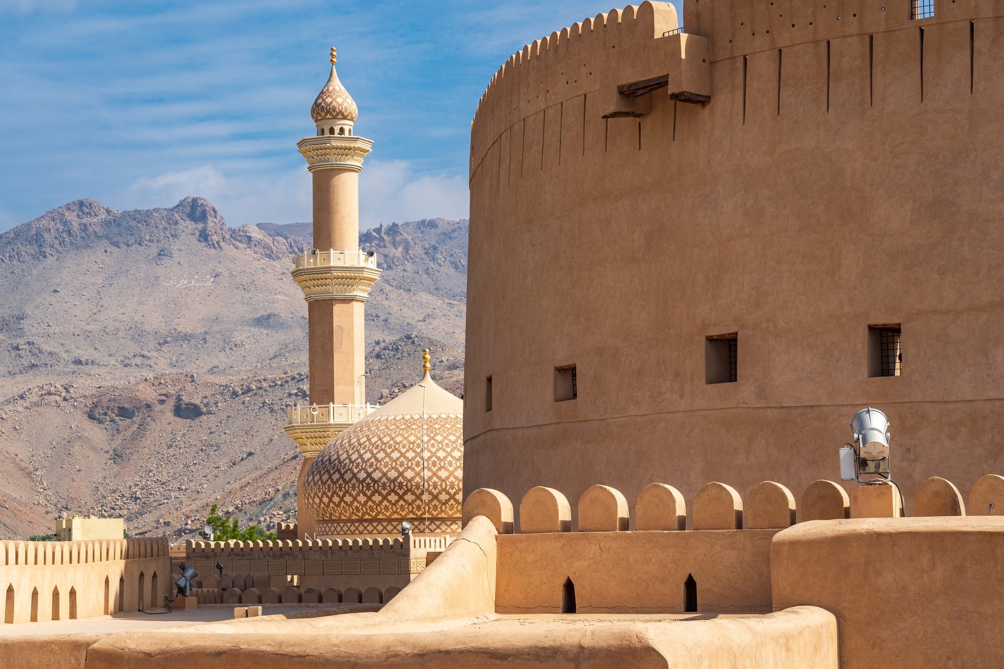
- 12Nizwa Fort and souq · Day 8
- 13Misfat al Abriyeen · Day 9
- 14Balcony Walk (W6) · Day 10
- 15Bahla Fort · Day 11
- 16Jabrin Castle · Day 11
- 17Ibri and As Sulaif · Day 11
- 18Bat · Day 12
- 19Al Ayn beehive tombs · Day 12
- 20Rustaq Fort · Day 13
- 21Nakhal Fort · Day 13
- 22Sultan Qaboos Grand Mosque · Day 14
- 23Mutrah Souq · Day 14
Day by day
Day 1
Muscat to Bimmah Sinkhole and Fins Beach- Supermarkets in Al Amerat
- 1Bimmah Sinkhole (Hawiyat Najm Park)
- Fins Beach
Details
Collect your car at the airport or at your hotel. Before you leave, ask our team to show you the rooftop tent, the electric fridge and its separate freezer, and the compressor. This is a two-week trip, so take time to pack the car well. Buy food and water in Muscat, because the shops get smaller further south. Then take the A2 (Route 17) out of the city. The highway crosses bare mountains and reaches the coast near Quriyat. Swim in the Bimmah Sinkhole in the afternoon and arrive in Fins before sunset.
- Supermarkets in Al Amerat — Large supermarkets on the A2 as you leave Muscat. Buy food and drinking water for at least three days and fill the tank.
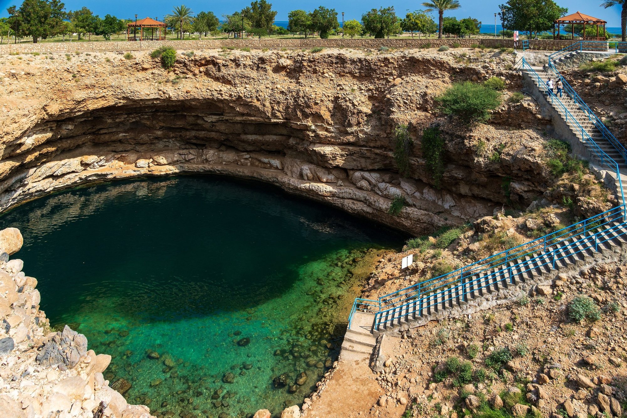
- 1Bimmah Sinkhole (Hawiyat Najm Park) — A limestone sinkhole with clear blue-green, slightly salty water inside a small park, between the villages of Dibab and Bimmah. Concrete steps lead down to the water, and you swim at your own risk: there is no lifeguard. The park has toilets, shade and picnic tables. In recent reports entry was free or about 500 baisa, so carry small cash and check before you go. Swim in modest swimwear or a T-shirt and shorts.
- Fins Beach — White sand and dark rocks along the sea. Walk along the shore at sunset.
Where to sleep: On firm ground behind the beach at Fins, at least 10 m back from the shoreline and at least 100 m from houses, away from fishermen's boats. Fins is in Muscat Governorate: you may camp for up to 48 hours without a permit, longer stays need a Muscat Municipality permit, and fires and barbecues are not allowed on the beach. Weekends (Friday and Saturday) are busy. You stay here two nights: if you leave on the morning of Day 3, you stay within the 48 hours.Tip: Open and close the rooftop tent once at the handover, in daylight. Then it takes only a few minutes on the first evening.Photo: Andries Oudshoorn · CC BY-SA 2.0
Day 2
Wadi Shab and Wadi Tiwi- 2Wadi Shab
- 3Wadi Tiwi
Details
A day for the two best-known wadis on this coast, with very little driving. Be at the Wadi Shab car park around 8:00, when the boats start running: in the morning the wadi is quiet and cool. After lunch, drive a few kilometres south to Tiwi and turn inland into Wadi Tiwi. A narrow road climbs between palm gardens, small villages and green pools towards Mibam, about 10 km up the wadi. Drive slowly, stop in the lower villages and walk. Return to Fins for a second night by the sea.
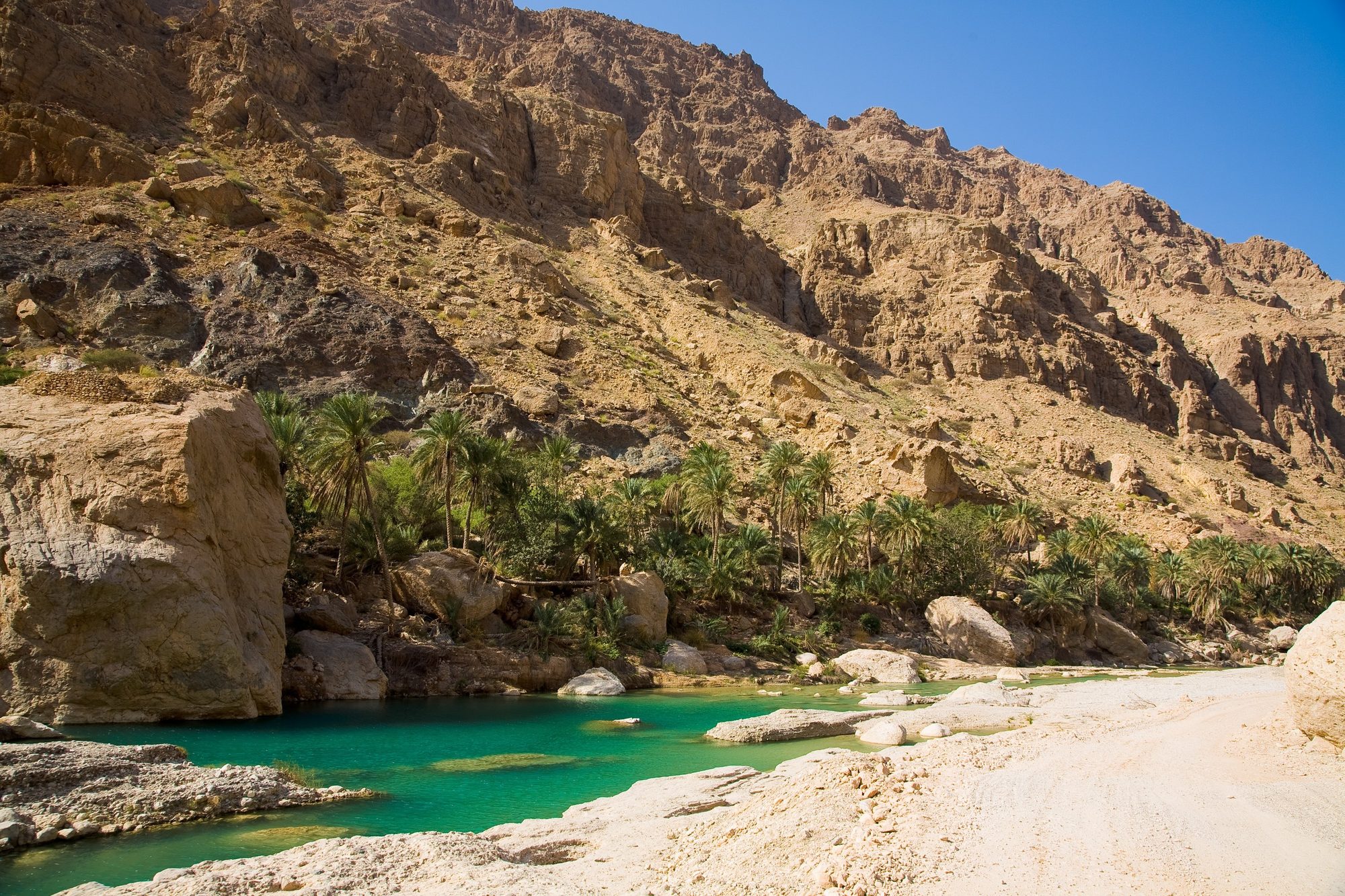
- 2Wadi Shab — Park under the highway bridge near Tiwi. A small boat takes you across the first pool: 1 OMR per person return in 2026, cash only, usually from about 8:00 to 17:00. The walk up the gorge to the deep pools takes 45–60 minutes each way. Strong swimmers can swim through a narrow gap into a cave with a waterfall. Wear water shoes, keep your phone in a dry bag, and do not go in if rain is forecast. Start the walk by 14:00 at the latest.
- 3Wadi Tiwi — A green wadi next to Wadi Shab, with palm gardens watered by aflaj, old villages and pools. Leave the A2 at the Tiwi exit, just after the bridge over Wadi Tiwi. A narrow road, mostly concrete, runs about 10 km up the wadi to the village of Mibam, where there are pools and a small waterfall. The upper part is very steep, with tight bends and narrow village lanes where you must give way to oncoming cars, and it can be slippery where water runs across it. Ask us before you drive the steep upper section to Mibam. Stay on the road: driving in the wadi bed or on a track along the wadi is not allowed with our cars. In the lower wadi, park where you do not block the road and walk. Never drive into flowing water, and do not go in if rain is forecast.
Where to sleep: The same spot at Fins as last night, at least 10 m back from the shoreline, at least 100 m from houses and away from fishermen's boats. Fires and barbecues are not allowed on the beach.Tip: Both wadis are busiest on Fridays and Saturdays. If your Day 2 is a Friday or a Saturday, be at Wadi Shab by 8:00, before the crowds. Swim in a T-shirt and shorts, and keep your phone in a dry bag.Photo: Muiad123 · CC BY-SA 4.0
Day 3
Qalhat, Sur and the turtles of Ras al Jinz- Qalhat and the Bibi Maryam Mausoleum
- 4Sur dhow yard and Al Ayjah lighthouse
- 5Ras al Jinz Turtle Reserve
Details
A short driving day with time to look around. Stop at Qalhat, then drive on to Sur, an old trading port where wooden dhows are still built by hand. Watch the carpenters in the boatyard by the lagoon, then cross the bridge to Al Ayjah for the lighthouse and the view back over the old town. Fill the tank and buy fresh food and water in Sur, which has large supermarkets. In the late afternoon, drive on to Ras al Hadd at the eastern tip of Oman. Choose your spot for the night in daylight, have dinner and arrive at the reserve by 20:30 for the night tour.
- Qalhat and the Bibi Maryam Mausoleum — A short exit from the A2. This domed tomb from the early 14th century is the only building still standing in the old port city of Qalhat, a UNESCO World Heritage Site since 2018. The site has been closed at times in recent years for excavations, but you can see the mausoleum from the barrier. Check before you go.
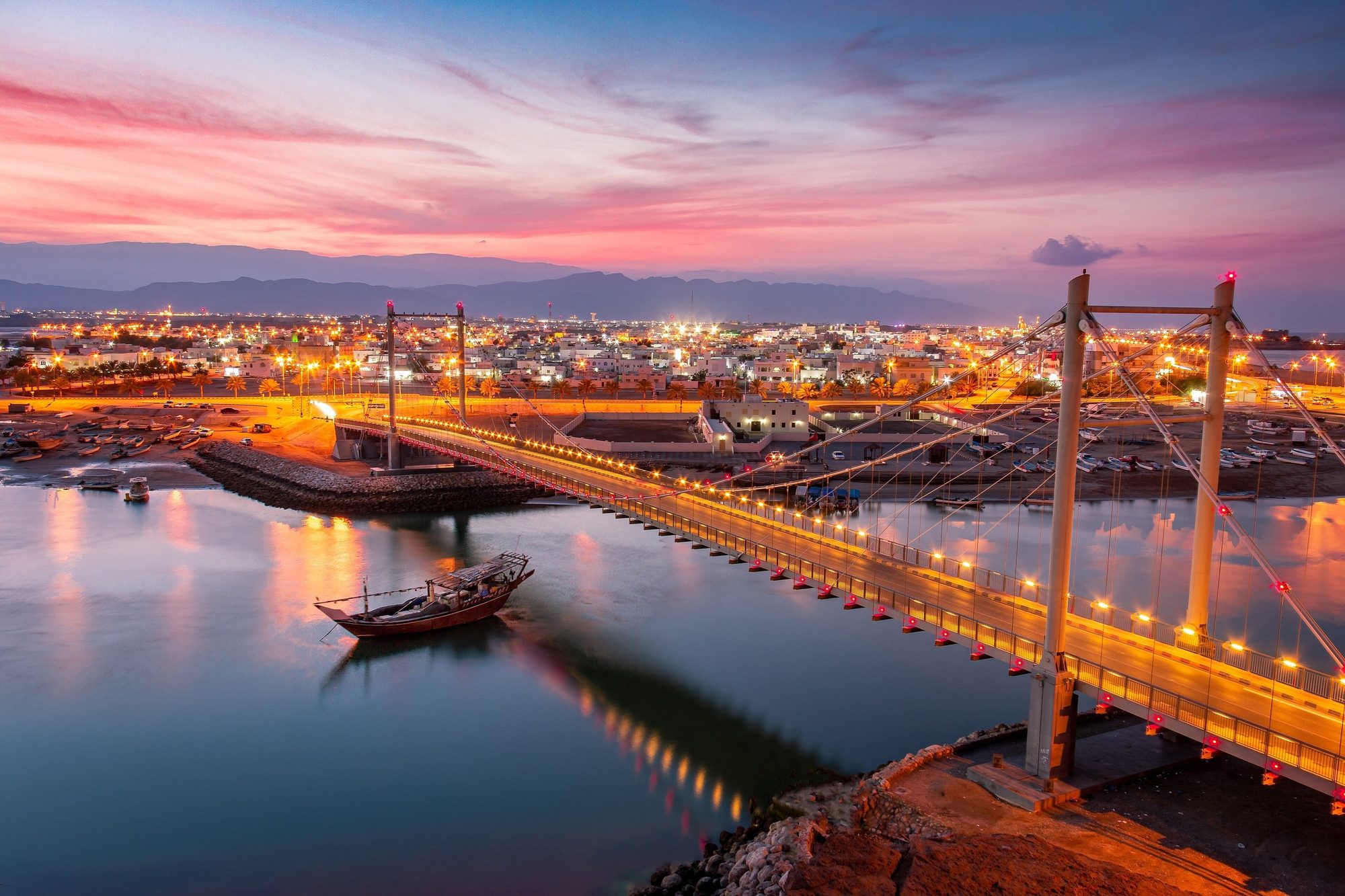
- 4Sur dhow yard and Al Ayjah lighthouse — Watch wooden dhows being built at the open-air yard by the lagoon, next to the bridge to Al Ayjah; a small fee may be charged. See the restored Fatah Al Khair dhow, then cross the bridge to the white lighthouse of Al Ayjah and walk the lanes of old houses. Ask before you photograph people.
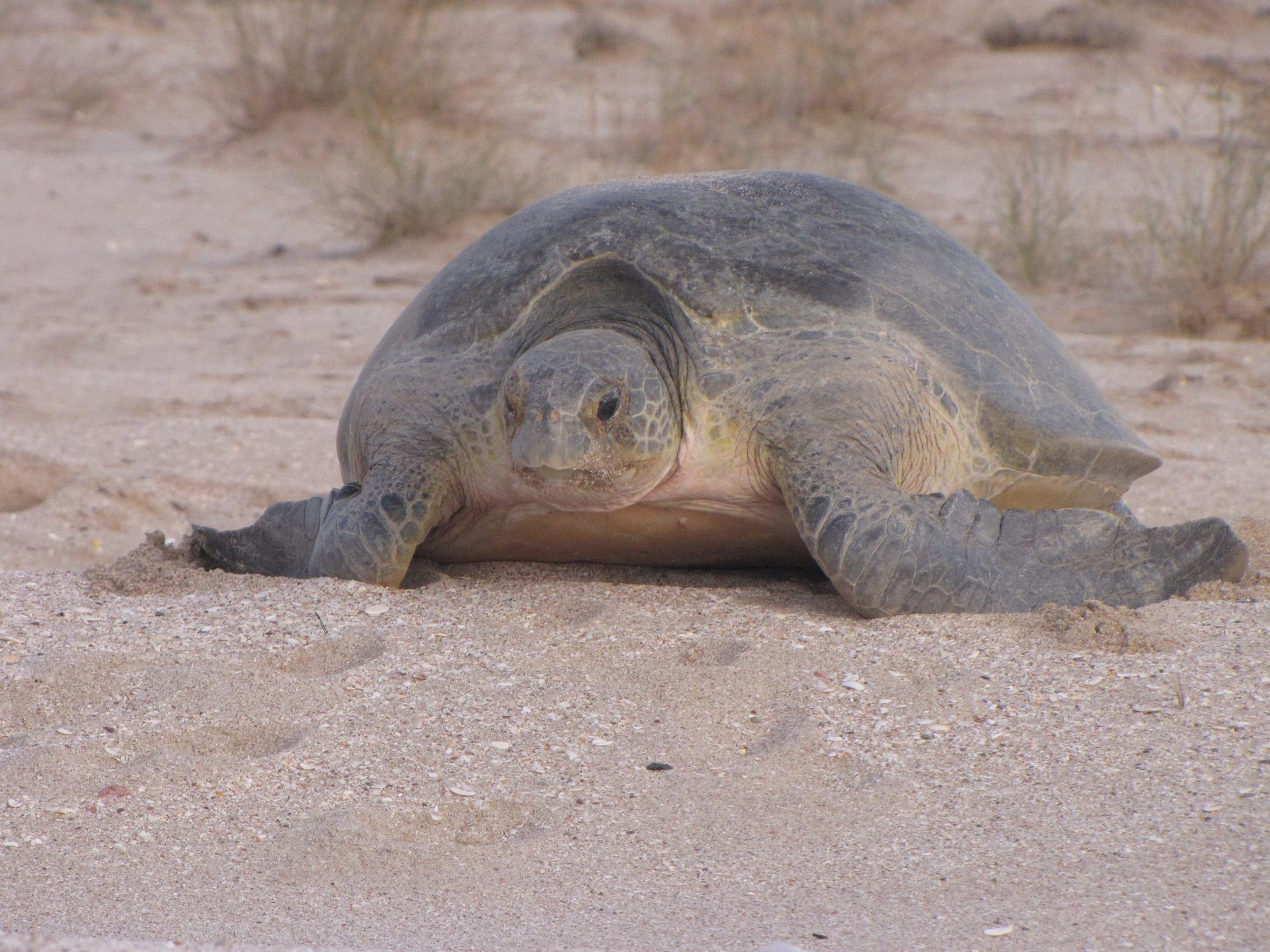
- 5Ras al Jinz Turtle Reserve — Guided night tour from 21:00 (arrive by 20:30). A reserve guide leads small groups onto the beach to watch green turtles nest. Plan about 1.5 to 2 hours. The guides use red torches only: no flash and no phone lights. In October 2026 the reserve's website listed OMR 12 per tourist adult and OMR 6 per child aged 6 to 12 (under 6 free). Times can change with the season, so confirm them when you book.
Where to sleep: Not on the beach. The coast from Ras al Hadd to Ras al Jinz is a protected turtle reserve: camping on the nesting beaches at night and driving on the beach are prohibited, and at night you may go onto the nesting beaches only with a reserve guide. Choose your spot in daylight, before the tour: flat gravel ground several kilometres inland, right next to the paved road, outside the reserve and away from villages, farms and wadi beds. Drive there slowly after the tour and stay on the paved road: our cars may not drive off-road after dark. If you prefer not to drive after dark, book a room or eco-tent at the reserve (room rates include the night and dawn turtle tours) or a hotel in Ras al Hadd.Tip: Book the turtle tour before your trip, online, by phone or by email; the contacts are on the reserve's official website. Places are limited, so book early for weekends and holidays.Photo: Andries Oudshoorn · CC BY-SA 2.0
Day 4
Ras al Jinz to Wadi Bani Khalid and the Wahiba Sands- Ras al Jinz dawn tour
- 6Wadi Bani Khalid
- 7Al Wasil
Details
If you saw no turtles last night, join the dawn tour at 5:00 (a separate ticket unless you stay at the reserve). Then drive back to Sur and take the N4 inland across wide gravel plains. A side road climbs into the hills to Wadi Bani Khalid, where green pools lie between palm trees and large boulders. In the afternoon, return to the N4 and drive west to Al Wasil. Lower your tyre pressure there and follow the marked track into the orange dunes of the Wahiba Sands.
- Ras al Jinz dawn tour — Starts at 5:00; arrive by 4:45. You may see the last turtles going back to the sea and, in season, hatchlings.
- 6Wadi Bani Khalid — Entry is free, and most 2025–2026 reports say parking is free too. The car park toilets cost about 400 baisa and the changing tents about 100 baisa, in cash. The first pools are less than 5 minutes' walk from the car park, and Muqal Cave is about 1 km further up the wadi. Bring a head torch for the cave. Signs ask swimmers to cover upper arms and knees.
- 7Al Wasil — Fill the tank at Al Wasil, the last fuel before the sand. Lower the tyres to about 18–20 psi (1.2–1.4 bar) with the gauge in your kit before you leave the tarmac. Small tyre shops in the area can also help.
Where to sleep: Book two nights. Option 1: a desert camp on a marked track from Al Wasil or Al Mintirib. Prices vary a lot. In 2025–2026 listings, simple camps started at roughly OMR 15–25 per person with dinner and breakfast, and luxury camps cost OMR 100 or more per tent per night. Prices change with the season, so check before you go. You can also ask a camp if you may sleep in your own rooftop tent and pay for dinner and showers. Option 2: the edge of the dunes. Stop on firm, flat ground, out of sight of houses, farms, camel pens and other camps. In daylight you may leave the track and drive onto the dunes to reach a spot, but do not drive on sand after dark.Tip: Plan to reach Al Wasil by 15:30. From mid-November to January the sun sets between about 17:20 and 17:50, and our cars may drive on sand only in daylight. If you are late, skip the walk to Muqal Cave.Day 5
A slow day in the Wahiba Sands- Sunrise dune walk
- Al Mintirib
- Camel ride or Bedouin visit
- Guided dune trip
Details
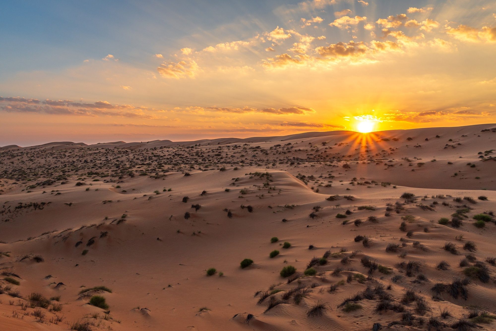
Stay a second night in the desert. Walk up a dune for the sunrise and have a slow breakfast. In the cooler morning, drive out on the marked track to the old town of Al Mintirib on the northern edge of the sands. Back at camp, rest in the shade during the hot hours. Your camp can arrange a camel ride or a visit to a Bedouin family. Return to the dunes on foot for the sunset and a dark, clear night sky.
- Sunrise dune walk — Start walking up the nearest high dune about 30 minutes before sunrise, which is between about 6:10 and 6:45 from November to January. Walk, do not drive: it is not yet daylight, and you may drive on the dunes only in daylight.
- Al Mintirib — An old town about 9 km from Al Wasil, with a large mud-brick fort, palm gardens and old houses. Reports on the fort differ: some say it opens only on weekday mornings, others that it is closed for restoration. Check locally; you can always see it from outside.
- Camel ride or Bedouin visit — Ask your camp. Prices vary a lot between camps, so agree the price before you start.
- Guided dune trip — You may drive on the dunes in your rental car, but only in daylight: keep the tyres lowered and use low range. If you have never driven on sand, start with small dunes, or book a trip with a licensed local driver in their own vehicle to see the high dunes up close.
Where to sleep: Stay at the same camp or the same spot at the edge of the dunes. If you move to another camp, use its marked track and arrive before dark.Tip: The sand is very hot at midday and the light is flat. Plan walks for the first and last two hours of daylight, and drink often even when it feels cool. Desert nights from December to February are cool, often around 10–15 °C and sometimes colder, so keep warm layers ready.Photo: Bernhard Dunst · CC BY-SA 4.0
Day 6
Wahiba Sands to Al Mudayrib, Ibra and Jebel Akhdar- Al Mudayrib
- 8Ibra
- 9Birkat al Mawz
- Jebel Akhdar checkpoint
Details
Drive out on the same track in the cool morning and pump the tyres back to road pressure in Al Wasil before the highway. Stop in the old towns of Al Mudayrib and Ibra, then cross the plains west to Birkat al Mawz, an oasis town at the foot of Jebel Akhdar. Buy fuel, food and water there for two days. About 7 km up the D518 is the police checkpoint. From the checkpoint, the road gains about 1,200 m in some 30 km to the Saiq plateau, at around 1,900 to 2,000 m. Aim to arrive by mid-afternoon, so you choose your camp spot in daylight.
- Al Mudayrib — A short detour from the N4, about 20 km from Al Wasil towards Ibra. Walk the lanes of the old town to the fort, the hilltop watchtowers and the remains of the old souq.
- 8Ibra — Walk through the old quarter with its large mud-brick houses, many now in ruins. On Wednesday mornings, from about 6:00 until late morning, the women's souq sells fabrics, clothes, crafts and food. It is for women only, so men cannot go in. If today is a Wednesday, leave camp by 7:30 and go to Ibra first; Al Mudayrib is then a detour of about 45 km there and back, so skip it if you are short of time. Dress modestly and ask before you take photos of people.
- 9Birkat al Mawz — Walk through the palm gardens and the ruined old quarter below the mountain. Falaj Al Khatmeen, one of the five aflaj (water channels) on the UNESCO World Heritage list, runs through the courtyard of Bayt Ar-Ridaydah, a 17th-century fortified house that is open to visitors.
- Jebel Akhdar checkpoint — About 7 km up the D518 from Birkat al Mawz. Only 4x4 vehicles may continue, and the rule is enforced. Have your passports, driving licences and the car registration card (mulkiya) ready.
Where to sleep: Plan two nights on the plateau. Camp on open public ground, well away from houses, farms, terraces and hotels. Several popular spots with views into the gorges are on the rocky western part of the plateau, towards the Alila hotel. Park on a flat gravel spot and do not drive over plants. Jebel Akhdar became a UNESCO biosphere reserve in 2025, and part of the mountain is the Al Jabal Al Akhdar Scenic Reserve, where camping or staying overnight needs a permit from the Environment Authority. Respect any signs and fences, and if you are not sure, ask at your hotel or at the checkpoint. Take all rubbish with you and cook only on the stove. From December to February the nights are cold, sometimes close to freezing.Tip: Fill the tank in Birkat al Mawz. There is only one fuel station on the plateau (Al Maha, in Saiq), and the climb uses more fuel than usual.Day 7
A day on foot on Jebel Akhdar- 10Al Aqur, Al Ayn and Ash Shirayjah (path W18b)
- 11Wadi Bani Habib
- Sunset over the terraces
Details
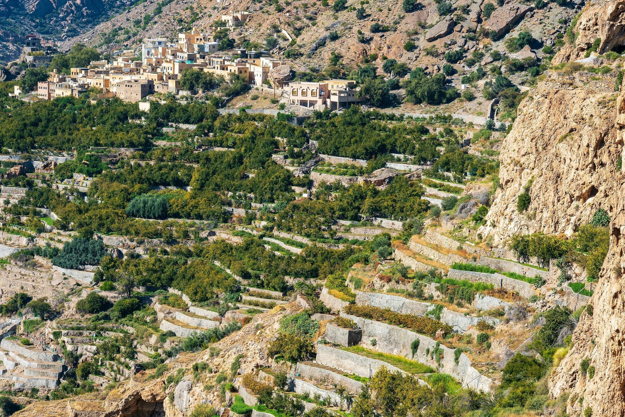
Leave the car parked for most of the day and explore on foot. In the cool morning, walk the path through the terraced villages on the edge of the gorge. After lunch, drive to the end of the D518 and walk down into Wadi Bani Habib. Return to the rim for the sunset over the terraces. From about mid-March to early May, the damask roses on the terraces are picked to make rosewater.
- 10Al Aqur, Al Ayn and Ash Shirayjah (path W18b) — A signposted path links three villages on the edge of the gorge, about 4 km one way, with many steps and some rocky parts. The terraces grow pomegranates, walnuts and the damask roses used for rosewater. Allow 3 to 4 hours for the full path there and back. Stay on the path, and do not walk on the terraces or pick fruit or flowers.
- 11Wadi Bani Habib — The D518 ends here. From the car park, stone steps lead down into a green valley with walnut and other fruit trees and the ruins of an abandoned village of mud and stone houses. Allow 1 to 1.5 hours there and back.
- Sunset over the terraces — Diana's Point is inside the grounds of the Anantara resort, but there is a free viewpoint with a similar view over the terraces next to the Layali Al Jabal restaurant nearby.
Where to sleep: The same spot as last night, or another on open public ground on the plateau, away from houses, farms, terraces and hotels, and outside the scenic reserve unless you have a permit. There is no drinking water at the camp spots, so bring enough up from Birkat al Mawz.Tip: The air is cool at 2,000 m, but the sun is strong. Carry at least 2 litres of water per person on the village path, wear a hat, and start by about 8:00.Photo: dconvertini (Domenico Convertini), via Flickr · CC BY-SA 4.0
Day 8
Jebel Akhdar to Nizwa- 12Nizwa Fort and souq
- Falaj Daris
Details
An easy day after the mountain. Drive down from the plateau in a low gear after breakfast and check in at a hotel or guesthouse in Nizwa. Climb the round tower of Nizwa Fort and walk through the souq. Do the laundry and restock in the afternoon. In the late afternoon, walk beside Falaj Daris in a small park north of the town.
- 12Nizwa Fort and souq — Climb the round tower of the 17th-century fort, 34 m high, for a view over the palm oasis. The fort opens daily at 8:00, with a midday break on Fridays from about 11:30 to 13:30. Closing time is given as 18:00 or 20:00 depending on the source, so check before you go. Entry is about 5 OMR per adult (2025-2026). Then walk through the souq next to the fort.
- Falaj Daris — One of the five aflaj (water channels) on the UNESCO World Heritage list, often described as the largest in Oman. A short section north of Nizwa runs through a small public park with shade and picnic areas. Stay out of the channel when the water runs fast after rain.
Where to sleep: We suggest a hotel or guesthouse in Nizwa tonight, for a shower, a bed and clean clothes after seven nights in the tent. Ask at the hotel about laundry, and book ahead for Thursday and Friday nights.Tip: On the long descent from Jebel Akhdar, use a low gear (L or manual mode in an automatic) and let the engine hold the car. Do not keep your foot on the brake: brakes overheat on long steep roads. The road has escape lanes for vehicles whose brakes fail.Day 9
Nizwa to Al Hamra, Misfat and Jebel Shams- Nizwa goat market (Fridays)
- Al Hamra
- 13Misfat al Abriyeen
- Wadi Ghul viewpoints
Details
If today is a Friday, start at the goat market in the souq. Then drive north-west to Al Hamra and Misfat al Abriyeen, two old villages above palm gardens. Fill the tank at the Shell station in Al Hamra: there is no fuel station on Jebel Shams. The mountain road climbs past Ghul in steep bends. Near the top, parts of the road are graded gravel, and a two-year upgrade of the road started in January 2026, so expect roadworks, diversions and changing surfaces. Arrive before sunset, which from November to January is between about 17:25 and 17:55.
- Nizwa goat market (Fridays) — On Fridays from about 6:30 to 9:30, farmers trade goats and cattle in the auction ring at the souq. Arrive by 7:00 and dress modestly.
- Al Hamra — The old quarter is one of the best-preserved mud-brick quarters in Oman, with rows of houses several storeys high. In Bait al Safah, a restored family house run as a small museum, local women show how Omani bread, coffee and other traditional products are made.
- 13Misfat al Abriyeen — Park at the village entrance, or in the car park further back when it is full, and walk down the lanes beside the falaj to the gardens. Allow 1 to 2 hours. Cover shoulders and knees, do not pick fruit, do not swim in the falaj pools, and stay out of private houses and the mosque.
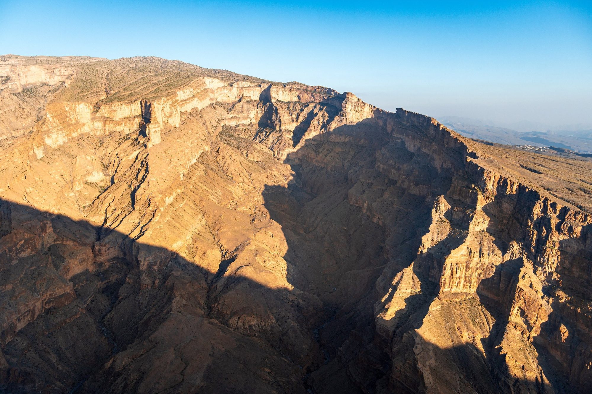
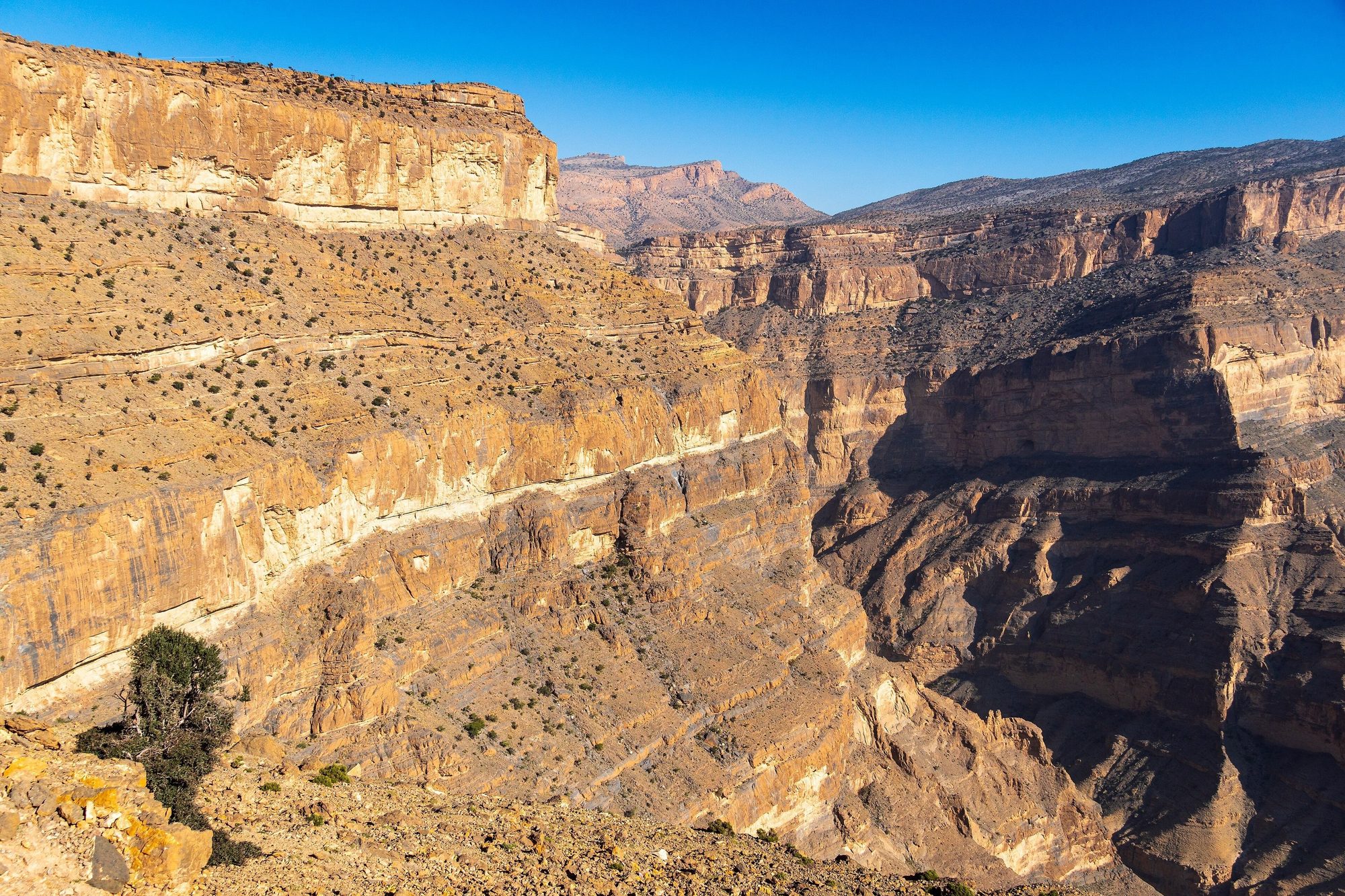
- Wadi Ghul viewpoints — Stop near Ghul to see the ruined old village on its rocky hill at the mouth of the canyon. Higher up, several parking areas look down into the gorge, which is about 1,000 m deep.
Where to sleep: Plan two nights on the canyon rim between the Jebel Shams Resort and Al Khitaym, where the road ends, or on the open plateau before the resorts. Park on a flat spot well back from the edge and away from village houses. There is no water and no free toilet; the resorts and the walking trail have small paid toilets. Keep food and rubbish inside the car, because goats roam the rim and eat whatever is left out. Building work for a new visitor area is under way on the mountain, so some spots may be fenced off. The rim is windy, and from December to February the nights can drop to around or below 0 °C.Tip: Leave Al Hamra by about 15:00: the drive up to the rim takes about 1.5 hours, and you want daylight to choose your spot.Day 10
The Balcony Walk and a quiet day on Jebel Shams- 14Balcony Walk (W6)
- Canyon rim at sunset
Details
Watch the early light on the canyon walls, then start the Balcony Walk early, while it is still cool. Have lunch back at camp and rest in the shade in the hottest hours. In the late afternoon, walk along the rim to the viewpoints and watch the sunset over the canyon. This is the second night in the same spot, so there is nothing to pack.
- 14Balcony Walk (W6) — The signposted path starts at Al Khitaym and follows a ledge along the canyon wall to the abandoned village of As Sab. It is about 8 km there and back. You lose a few hundred metres of height on the way out (sources give 200 to 350 m) and climb it again on the way back. Allow 3 to 5 hours, and more with long breaks. Most of the path has no railings, so it is not for people with vertigo. The small toilets at the start and along the path cost a few hundred baisa (about 0.3 to 0.5 OMR), so carry coins.
- Canyon rim at sunset — Walk along the rim from your camp to look down into the Wadi Ghul canyon, about 1,000 m deep. Stay well back from the edge.
Where to sleep: The same spot on the canyon rim. Keep food and rubbish inside the car because of the goats, and keep warm layers ready: the rim is windy and winter nights can drop to around or below 0 °C.Tip: Start the walk by about 8:00 and carry at least 2 litres of water per person. Past the resorts, the tracks along the rim get rougher: use only existing tracks, and ask us if you are not sure about one.Photo: J. R. Schmid · CC BY 3.0
Day 11
Bahla, Jabrin and Ibri- 15Bahla Fort
- 16Jabrin Castle
- 17Ibri and As Sulaif
Details
Leave the rim after breakfast and drive down in a low gear to Al Hamra and on to Bahla. Visit Bahla Fort and then Jabrin Castle, about 10 km away. Then take the N2 north-west across gravel plains to Ibri, the main town of Al Dhahirah. In the afternoon, walk through As Sulaif, an abandoned walled village on a rocky hill at the edge of the town. Fill the tank and buy food and water in Ibri.
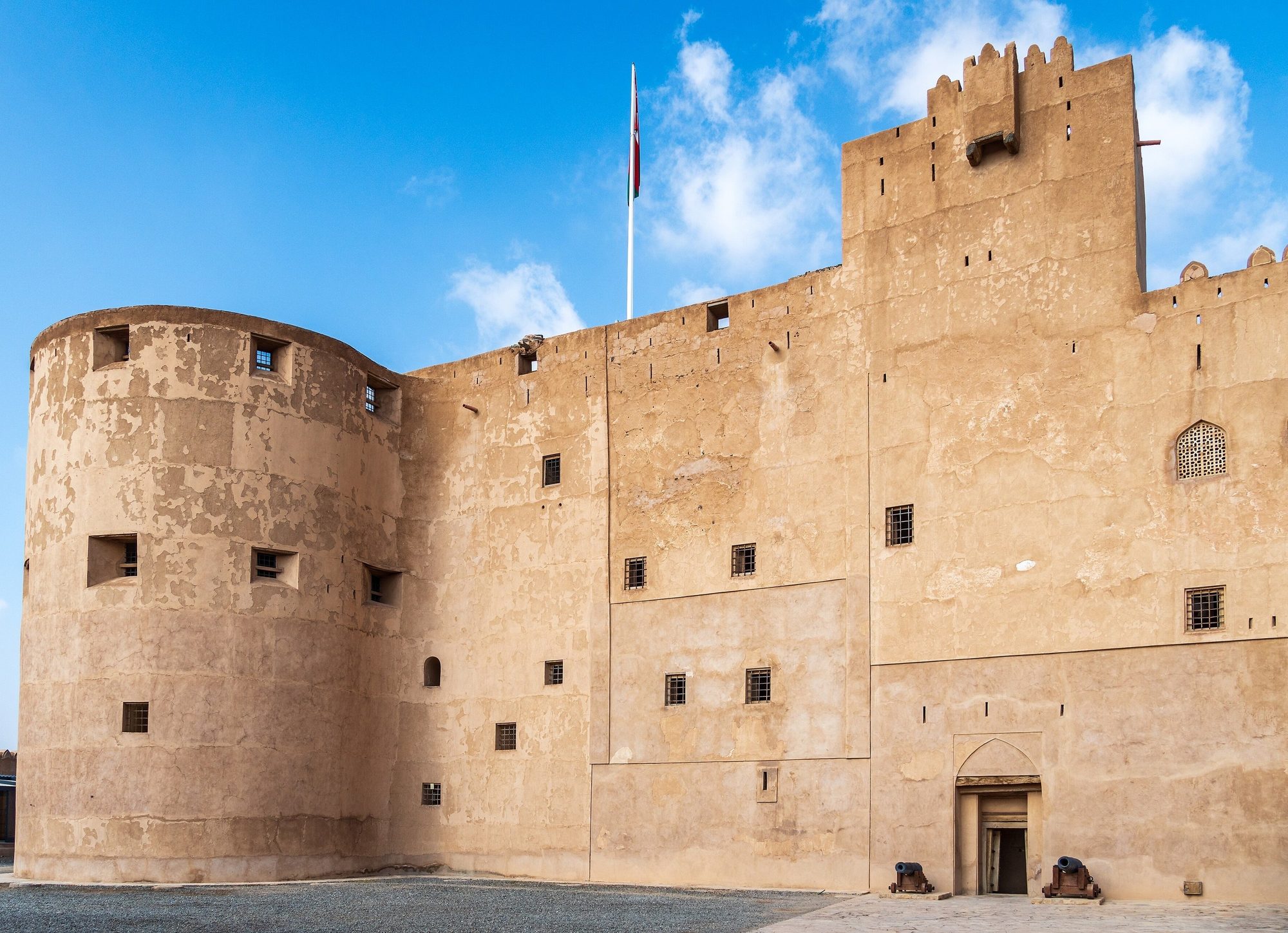
- 15Bahla Fort — The first site in Oman on the UNESCO World Heritage list (1987): a large mud-brick fort above a palm oasis, inside an old town wall more than 12 km long. The official site gives 8:00 to 19:00 daily, but visitors in 2025 reported closing at 16:00 and Friday mornings only, so arrive early. Entry is OMR 4–5 per adult; check before you go. Bahla is also known for its potters.
- 16Jabrin Castle — A palace completed in 1675 for Imam Bil'arab bin Sultan, with painted wooden ceilings, carved doors and the Sun and Moon room. Open daily 7:30 to 21:00; entry about 3 OMR per foreign adult, check before you go.
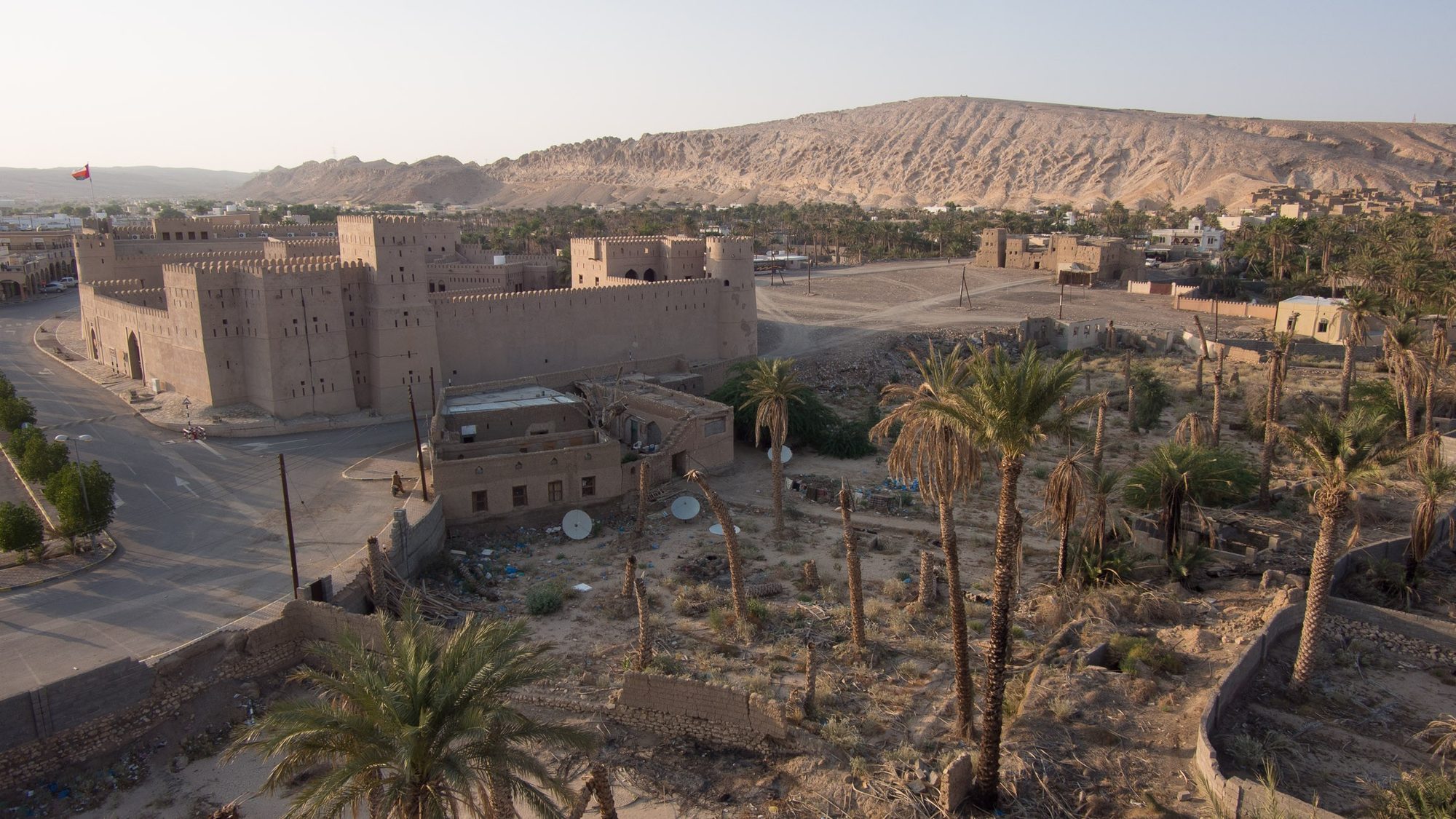
- 17Ibri and As Sulaif — Ibri is a large oasis town. Its fort, restored and opened to visitors in 1995, stands by the old souq in the centre, and the town has fuel stations and large supermarkets. As Sulaif, about 5 km from the centre, is an abandoned walled village of mud-brick houses on a rocky hill, with a fort from the early 18th century, seven towers, a large mosque and the remains of an old souq. Walk carefully: many of the old houses are crumbling. Cover shoulders and knees.
Where to sleep: Option 1: a hotel in Ibri; book ahead. Option 2: open public ground outside Ibri, only if you arrive well before sunset. Stop on firm gravel next to the paved road or a well-used graded track, out of sight of houses, farms and camel pens, and never in a wadi bed. Take all rubbish with you.Tip: Al Dhahirah borders Saudi Arabia and the UAE. Our cars may not leave Oman, so do not drive towards the borders or beyond any army or police checkpoint.Photo: Esra1993 · CC BY-SA 4.0
Day 12
Bat, Al Ayn and over the mountains to Rustaq- 18Bat
- 19Al Ayn beehive tombs
- The A6 over the mountains
Details
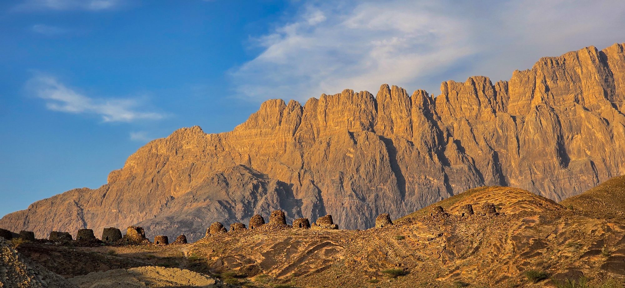
A full day, so leave Ibri by 7:30. At Bat, stone tombs and round towers from the 3rd millennium BC lie on low ridges beside a palm grove. About 40 km away by road, the beehive tombs of Al Ayn stand in a row on a ridge below the cliffs of Jebel Misht. Fill the tank near Bat: from there to the Rustaq side of the mountains there is no fuel station for about 120 km. In the afternoon, the A6 climbs over the western Hajar Mountains and winds down to Rustaq on the Batinah side. Arrive before sunset.
- 18Bat — Part of the UNESCO World Heritage Site of Bat, Al-Khutm and Al-Ayn (1988). Around 3000 BC, people here traded copper and stone with Sumer in Mesopotamia. The necropolis has about 100 stone tombs, and there are large round stone towers whose purpose is not known. There is no visitor centre and no official entrance: in 2023 reports, visitors went in through a gap in the fence marked by a small archaeological-site sign. A visitor reception centre was put out to tender in December 2023, so access may change: check before you go. Do not climb on the tombs and take nothing away.
- 19Al Ayn beehive tombs — The best preserved of the three sites: about 20 stone beehive tombs in a row along a ridge, with Jebel Misht behind. Park by the road near the village, opposite the small mosque, and walk about 10 minutes across the dry wadi bed and between the farms, then up the hillside. There is no fence and there are no facilities. Do not go after heavy rain, keep to the paths between the farms, and do not climb on the tombs.
- The A6 over the mountains — A paved mountain road of about 105 km from Al Ayn to Rustaq, with long climbs, tight bends and few villages. OpenStreetMap shows no fuel station between the Shell station near Bat and the Rustaq side of the mountains, so fill up first. Use a low gear on the descents. The tracks into the side wadis, such as Wadi Sahtan, are not part of this route, and driving on a track through or along a wadi is not allowed with our cars.
Where to sleep: Option 1: one of the few small hotels in Rustaq; book ahead and check before you go. Option 2: open public ground in the gravel foothills off the A7, only if you arrive well before sunset. Stop next to the paved road or a well-used graded track, out of sight of houses and farms, and never in a wadi bed. Take all rubbish with you.Tip: If you are late, skip Bat: Al Ayn is the better preserved site. Drive the A6 in daylight: it is a long mountain road, and camels and goats walk onto it near the villages.Photo: Ondřej Žváček · CC BY 2.5 (multi-licensed with GFDL and CC BY-SA 3.0 migrated; CC BY 2.5 is the simplest to use)
Day 13
Rustaq Fort, Nakhal and Ain al Thowarah to Muscat- 20Rustaq Fort
- Al Hazm Fort
- 21Nakhal Fort
- Ain al Thowarah
Details
Be at Rustaq Fort when it opens in the morning. If you have time, drive north to Al Hazm Fort and back. Then drive east on the A7, along the foot of the mountains, to Nakhal. Nakhal Fort stands on a rocky outcrop above the palm groves. A few kilometres further, the warm spring of Ain al Thowarah flows out of the rock into a green wadi. Have a picnic there, then take the A7 to Barka and the expressway to Muscat, and check in at your hotel.
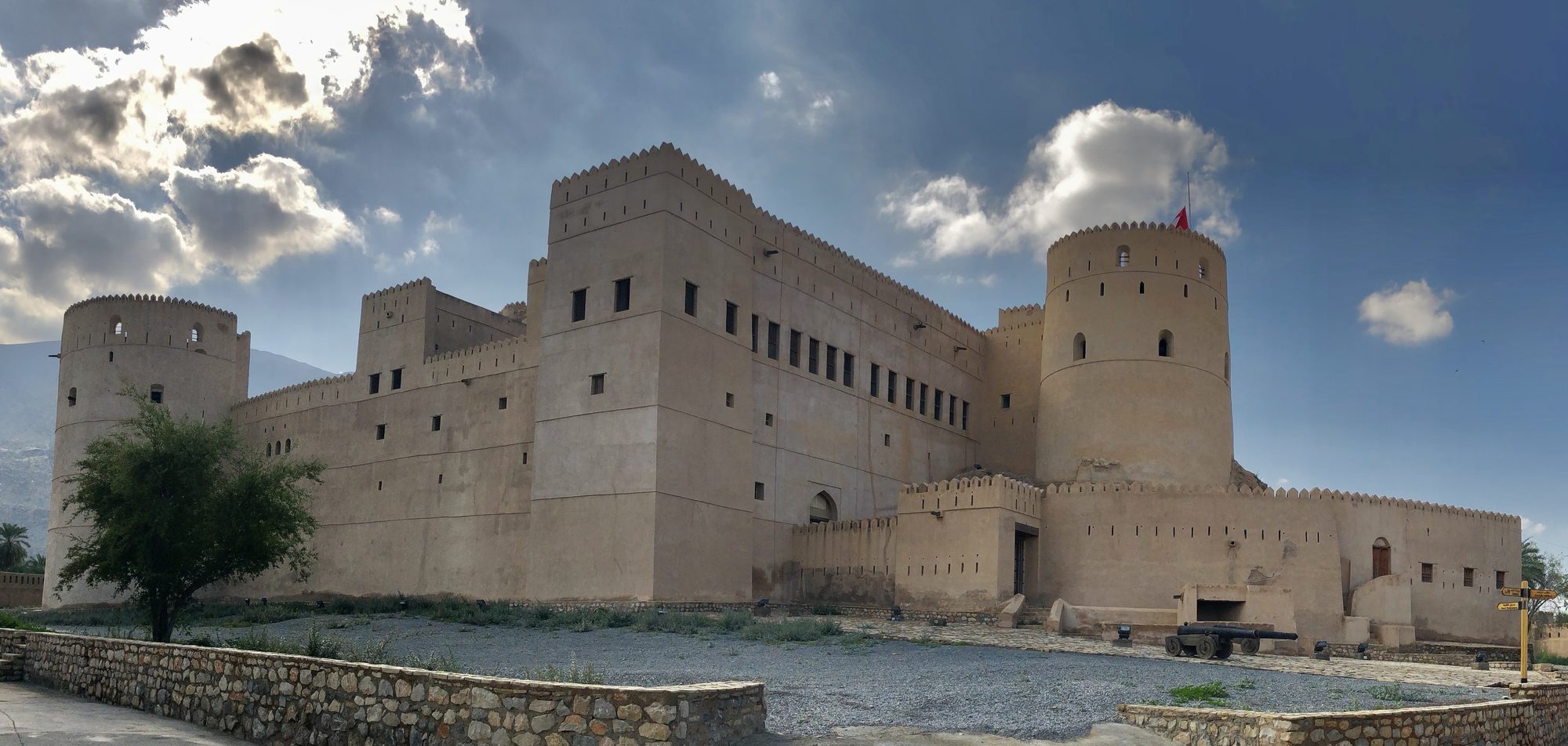
- 20Rustaq Fort — A large fort first built around 1250 and largely rebuilt by the first Ya'ariba imams in the 17th century, with four towers, the tallest more than 18 m high. Hours differ between sources: on Fridays it opens only in the morning, from about 8:00 or 8:30 until about 11:00, and on other days from about 8:30 or 9:00 until 13:00 or 16:00. Entry was about 500 baisa in 2023. Check before you go.
- Al Hazm Fort — A square fort from the early 18th century, built by Imam Sultan bin Saif II, with two towers, arched stone ceilings, tunnels and old Portuguese and Spanish cannons. The national tourism site gives Saturday to Thursday 7:30 to 18:00 and Friday 9:00 to 18:00, with tickets at the reception; an older guide gives Friday 8:00 to 11:00 only. Check before you go.
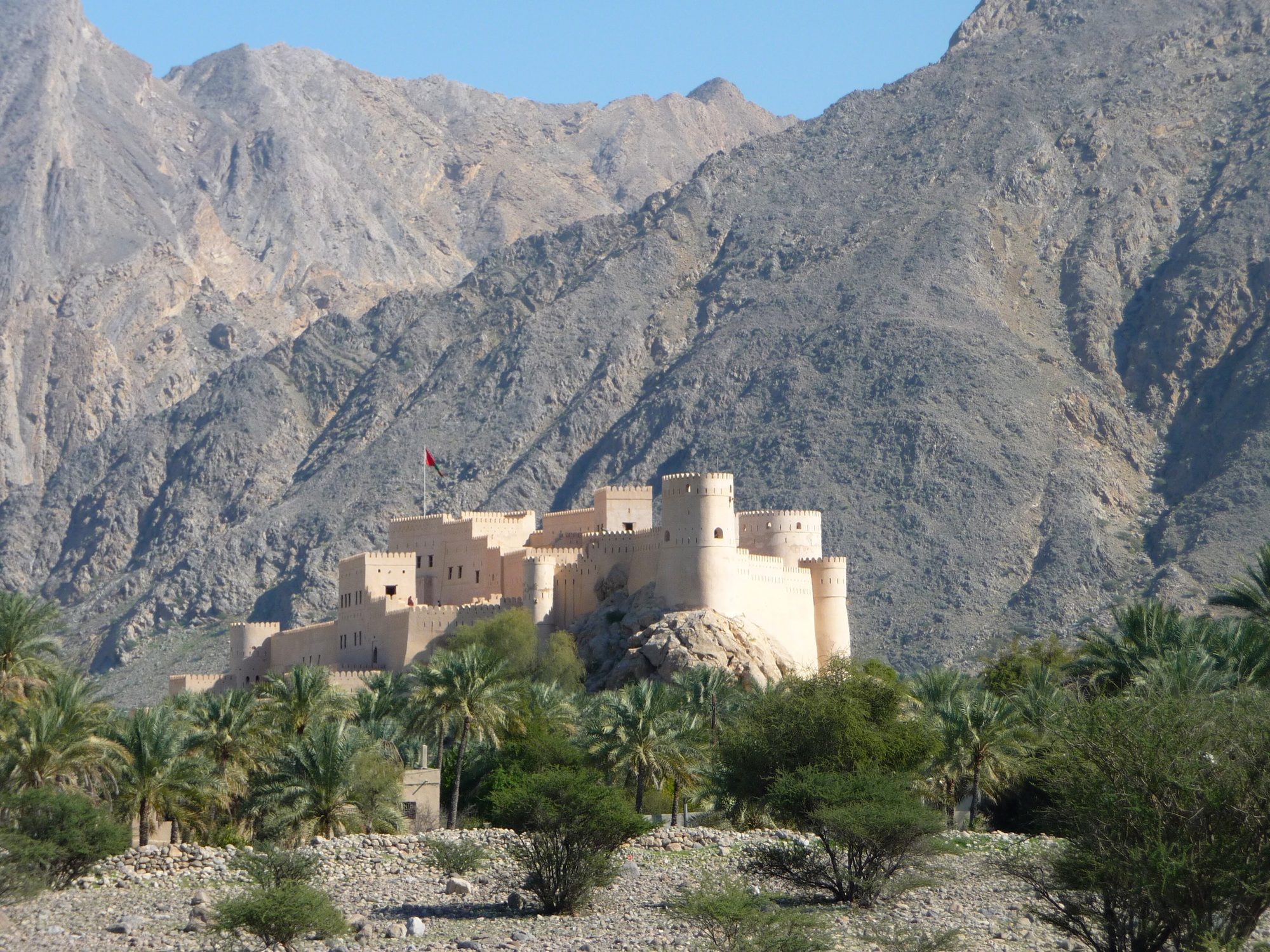
- 21Nakhal Fort — A fort built on a large rocky outcrop above the palm groves of Nakhal, rebuilt in the 17th century and last restored in 1990, with six towers, the wali's rooms and wide views from the walls. The national tourism site gives 8:00 to 22:00 daily, with tickets at the reception; older guides give shorter hours and only a Friday morning. Go in the morning and check before you go.
- Ain al Thowarah — A warm spring a few kilometres past the fort, along a narrow road through the palm gardens. The water flows all year from the rock into a stream and the falaj channels that water the date gardens, and a small concrete pool lets you sit in the warm water. There are picnic tables, and it is busy in the evenings, at weekends and on holidays. Where water runs across the road, park and walk: never drive into flowing water. Swim in a T-shirt and shorts.
Where to sleep: No camp tonight: book a hotel in Muscat for the last night, for example in Qurum, between the Grand Mosque and Mutrah, or in Mutrah, by the souq. In Muscat Governorate, camping is limited to the areas the municipality allows, at least 10 m back from the beach, and stays over 48 hours need a municipal permit.Tip: Wadi Al Abyad, near Nakhal, is known for its white pools, but the tracks into it run mostly along the wadi bed. It is not part of this route, and driving in a wadi bed or on a track along a wadi is not allowed with our cars.Photo: Eduard Marmet · CC BY-SA 2.0
Day 14
Muscat: the Grand Mosque, Mutrah and the return- 22Sultan Qaboos Grand Mosque
- 23Mutrah Souq
- Mutrah Corniche
Details
Start at the Sultan Qaboos Grand Mosque, which non-Muslims may visit only in the morning, from Saturday to Thursday. Then drive to Mutrah. Walk through the souq before it closes for the afternoon, and along the corniche by the harbour. Return the car at the airport or at your hotel; pick-up and return are between 08:00 and 20:00. If you start the trip on a Thursday, Day 14 is a Wednesday. If your Day 14 is a Friday, the mosque is closed to visitors, so see it on the morning of Day 1 instead.
- 22Sultan Qaboos Grand Mosque — Opened in 2001, with five minarets and, in the main prayer hall, one of the largest hand-woven carpets in the world. Non-Muslim visitors: Saturday to Thursday, from 8:00 according to the national tourism site or 8:30 according to the mosque's own site, until 11:00, so arrive after 8:30. Men need long trousers and a shirt that covers the shoulders; women must cover arms, legs and hair. Abayas and headscarves are available at the entrance. Take off your shoes before the prayer hall. Allow at least 1.5 hours. An entry fee of about OMR 8 was introduced in January 2025. Several 2026 guides say it was withdrawn after a few weeks and entry is free, but the national tourism site still lists OMR 8, so check before you go.
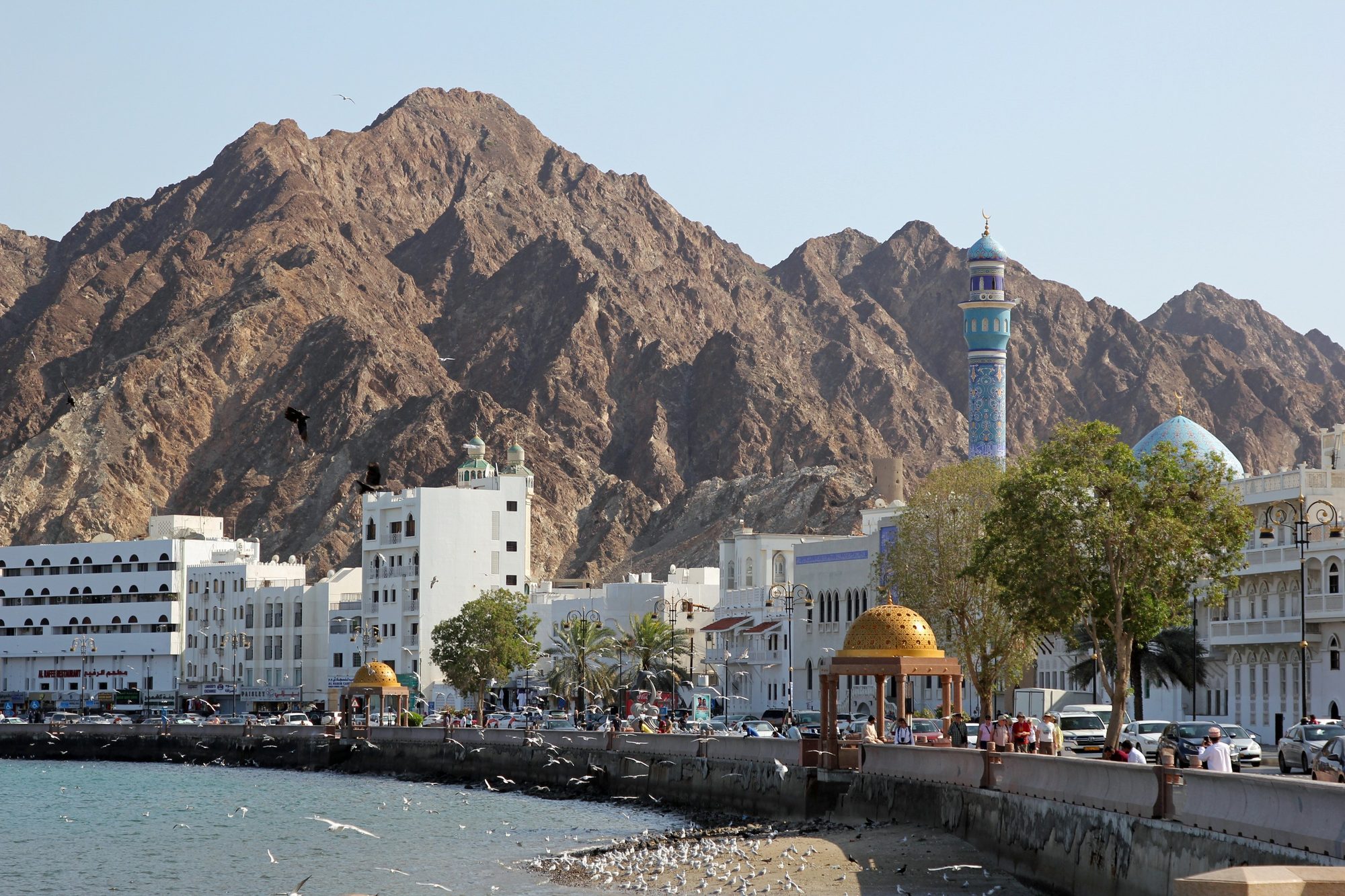
- 23Mutrah Souq — A maze of covered lanes off the corniche, selling frankincense, incense burners, spices, perfumes, Omani caps, khanjar daggers and gold. In October 2026 its hours were given as 9:00 to 13:00 and 16:00 to 23:00 from Saturday to Thursday, and 9:00 to 11:00 and 16:00 to 23:00 on Friday. Hours change during Ramadan and on public holidays.
- Mutrah Corniche — The curved seafront at Mutrah, beside Sultan Qaboos Port. Walk it in the morning or after sunset, when it is cooler.
Where to sleep: No camp tonight. Return the car at the airport or at your hotel in Muscat, between 08:00 and 20:00. If you stay another night, book a hotel.Tip: Visit the mosque first: it closes to visitors at 11:00, and the souq stays open until 13:00. With an evening flight you have time for both and a late lunch in Mutrah.
Which car?
Over two weeks you drive about 1,600 km and live out of the car for about nine nights, so space and comfort matter. The Toyota Land Cruiser Prado (OMR 75 per day, available from January) is the better fit for three or four people, thanks to its Family tent (2 adults + 2 children, or 3 adults), and it is quieter on the long N4 and N2 days. The Jeep Wrangler 4-door (OMR 55 per day) suits a couple who pack light, and it handles the Wahiba track, the Jebel Akhdar checkpoint and the gravel to the Jebel Shams rim just as well.
Practical tips
Read more
- Tyres and sand: before the sand track to your desert camp, lower the tyres to about 18–20 psi (1.2–1.4 bar). Drive slowly and steadily, without sharp turns or hard braking. Pump the tyres back up with the compressor before you drive on tarmac. If you get stuck, stop at once, do not spin the wheels, and use the recovery boards or call us.
- Dunes in daylight: in the Wahiba Sands you may drive on the tracks and on the dunes, but only in daylight. On the dunes, keep the tyres lowered and use low range. If you have never driven on sand, start with small dunes or take a local guide. Never drive on sand after dark.
- Beaches and turtles: our cars may drive on a beach in daylight, but only where the law allows it. At Fins, follow the signs: some beaches in Muscat are closed to cars. Pitch the tent above the high-tide line. At the turtle reserves of Ras al Hadd and Ras al Jinz, driving on the beach is banned, and you must not camp or light fires on the nesting beaches. Where beach driving is allowed, obey the signs, check the tide before you drive onto the sand and park above the high-tide line.
- Mountain roads: downhill, always use a low gear. In an automatic car, select L or manual mode. Brake in short, firm pushes, not all the time. The Jebel Akhdar road has escape lanes for a reason.
- Heat and cold: from November to March, daytime highs on the coast and in the desert are mostly about 25–33 °C. Desert nights from December to February are often around 10–15 °C, and at about 2,000 m on Jebel Akhdar and Jebel Shams the nights can be close to 0 °C. Bring a warm jacket, a hat and warm socks as well as summer clothes.
- Fuel: fill up whenever the tank is half empty. Fill the tank in Al Wasil before the sand, in Birkat al Mawz before Jebel Akhdar and at the Shell station in Al Hamra before Jebel Shams. There is one fuel station on the Saiq plateau and none on Jebel Shams. Before the A6 to Rustaq, fill up at the station near Bat: after it there is none for about 120 km.
- Tickets and cash: carry cash in small notes. In 2026 the Wadi Shab boat cost 1 OMR per person return and the Ras al Jinz turtle tour OMR 12 per tourist adult. Nizwa Fort costs about 5 OMR per adult, Bahla Fort OMR 4–5 and Jabrin Castle about 3 OMR (2025-2026 reports). Opening hours differ between sources and change on Fridays, during Ramadan and on public holidays. Check before you go. Rustaq Fort cost about 500 baisa in 2023.
- Dress code: cover shoulders and knees in villages, forts, souqs and at the wadis. Swim in a T-shirt and shorts or leggings, not in a bikini. Ask before you take photos of people. During Ramadan (expected around 8 February to 9 March 2027; the exact dates depend on the moon), eating, drinking or smoking in public during the day is against the law for everyone, including non-Muslims.
- Water and food: carry at least 5 litres of water per person per day, plus a reserve in the car. There is no drinking water at wild camp spots in the desert or on either plateau. Restock in Sur, Ibra, Birkat al Mawz and Nizwa. In the west, Ibri has large supermarkets.
- Showers and laundry: hotel nights fall in Nizwa (Day 8) and Muscat (Day 13), with optional hotel nights in Ibri and Rustaq. Ask at the hotel about laundry when you check in. A room at the Ras al Jinz reserve or a desert camp in the Wahiba Sands also gives you a shower.
- Maps and road numbers: download offline maps of the whole route before you leave Muscat, and save the GPS position of each camp. The phone signal is weak in the wadis, the dunes and the canyons. Oman renumbered its main roads in 2019, so maps and signs may show either the new numbers (A2, N4, N2) or the old ones (Route 17, 23, 15). Ignore sat-nav shortcuts onto gravel mountain roads.
- Wadis and rain: never camp in a wadi bed, because a storm far away can send a flood down a dry valley. Do not drive in wadis, even when they are dry: our cars may not go in a wadi bed or on a track through or along a wadi. Never drive into water or onto a flooded road, and stay out of the wadis if rain is forecast in the mountains. Friday and Saturday are the weekend in Oman, so the wadis are quieter on weekdays.
- Where you may drive: our cars may not leave Oman. You may drive on paved and mountain roads. In daylight only, you may also drive on existing gravel, rocky and sand tracks, the dunes and beaches where the law allows it. Driving in wadis is not allowed: not in a wadi bed and not on a track that runs through or along a wadi. Paved roads that cross or run beside a wadi are fine, and so is driving to a wadi car park to walk in. If you are not sure about a track, ask us. Some guides suggest crossing the mountains through Wadi Bani Awf (Snake Canyon) on a steep gravel track. It runs through the wadi, so it is not allowed with our cars.
- Camping: keep away from villages, farms and private land, and take all rubbish with you. Cook on the gas stove. Do not light fires on vegetation, and do not collect wood or cut plants: collecting firewood needs a permit in Oman, and cutting or burning trees is illegal. Never camp on archaeological sites such as Bat and Al Ayn.
Questions
Is 14 days enough to see Oman?
Two weeks is enough for all of northern Oman at an easy pace: the coast from Muscat to Ras al Jinz, Wadi Shab, Wadi Tiwi and Wadi Bani Khalid, the Wahiba Sands, Jebel Akhdar, Nizwa, Jebel Shams, and the old tombs and forts of Bat, Ibri, Bahla and Rustaq. No day has more than about 230 km of driving, and there are four two-night stops. Dhofar and Salalah in the far south are not included.
Can I add Salalah to two weeks in Oman?
By road it does not fit well. Salalah is about 1,000 km from Muscat each way, about 11 hours of driving without stops, and our cars must start and end in Muscat. To see Dhofar as well, take our 20-day route, which drives the coast to Salalah and back.
Which day of the week should I start the 14-day loop?
A Thursday start works well. Day 9 is then a Friday, the day of the goat market in Nizwa, and you sleep in Nizwa the night before. Day 14 is a Wednesday, when the Grand Mosque is open to visitors in the morning. Day 2 is a Friday, when Wadi Shab is busy, so be at the car park by 8:00.
Where do I sleep on a two-week trip?
About nine nights in the rooftop tent: by the sea at Fins, near Ras al Jinz, in the Wahiba Sands, on Jebel Akhdar and on Jebel Shams. You sleep in a hotel in Nizwa and in Muscat, and the nights in Ibri and Rustaq can be in the tent or a hotel. Desert camps in the Wahiba Sands have showers, and you can ask a camp if you may sleep in your own rooftop tent and pay for dinner and showers.
Do I need to book the turtle tour at Ras al Jinz?
Yes. Book before you travel, online, by phone or by email; the contacts are on the reserve's official website. At night you may go onto the nesting beaches of the turtle reserve only with a registered guide. The night tour starts at 21:00 (arrive by 20:30) and the dawn tour at 5:00 (arrive by 4:45); times can change with the season. In October 2026 the reserve's website listed OMR 12 per tourist adult and OMR 6 per child aged 6 to 12. From October to April there are fewer turtles than in summer and a sighting is not guaranteed.
Do I need a 4x4 for Jebel Akhdar and Jebel Shams?
For Jebel Akhdar, yes: a police checkpoint about 7 km up the road from Birkat al Mawz lets only 4x4 vehicles continue. For Jebel Shams there is no checkpoint, but the road is steep, parts near the top are gravel, and a two-year upgrade that started in January 2026 means roadworks and changing surfaces. Both DuneTribe4x4 cars, the Jeep Wrangler and the Toyota Land Cruiser Prado, are 4x4.
Can I add Dubai or Musandam to this trip?
Not with our cars: they may not leave Oman. Musandam is an exclave, separated from the rest of Oman by the United Arab Emirates, so you cannot drive there without crossing the border. This loop stays inside Oman from start to finish.
Ready to go?
Choose your dates. We hand over the car with the rooftop tent and the full camping kit at Muscat airport or at your hotel in Muscat.
More itineraries
 Dunes and wadisWahiba Sands · Wadi Bani Khalid · Sur
 The mountain loopNizwa · Jebel Shams · Jebel Akhdar
 The south coastSur · Ras al Jinz · Sugar Dunes
 One week in OmanCoast · Desert · Mountains
 The grand loopCoast · Wahiba Sands · Jebel Shams
 Oman in fullWahiba · Duqm · Salalah · Jebel Shams
 A month in OmanCoast · Desert · Dhofar · Mountains
Oman travel guides
Distances and driving times are approximate. Check road conditions, tides, weather and opening times before you go. Photos are licensed stock photos of the places, not of our cars.